
RI_635
Type of resources
Topics
Keywords
Contact for the resource
Provided by
Years
Formats
Representation types
Update frequencies
status
-
Monitor variations in seabird numbers and colony size in the St. Lawrence system. Survey of over 20 species of seabirds and herons during the breeding season, in order to monitor population dynamics through time and space. Seabird populations are influenced by food abundance and quality. There is actually more than 1,000,000 birds from more than 20 different species that breed in nearly 1,000 active colonies. Plongeon du Pacifique/Pacific Loon/Gavia Pacifica, Plongeon catmarin/Red-throated Loon/Gavia stellata, Macareux moine/Atlantic Puffin/Fratercula arctica, Guillemot à miroir/Black Guillemot/Cepphus grylle, Guillemot marmette/Common Murre/Uria aalge, Guillemot de Brünnich/Thick-billed Murre/Uria lomvia, Petit Pingouin/Razorbill/Alca torda, Mouette tridactyle/Black-legged Kittiwake/Rissa tridactyla, Goéland marin/Great Black-backed Gull/Larus marinus, Goéland argenté/Herring Gull/Larus argentatus, Goéland à bec cerclé/Ring-billed Gull/Larus delawarensis, Mouette rieuse/Common Black-headed Gull/Larus ridibundus, Sterne caspienne/Caspian Tern/Sterna caspia, Sterne pierregarin/Common Tern/Sterna hirundo, Sterne arctique/ArcticTern/Sterna paradisaea, Sterne de Dougall/Roseate Tern/Sterna dougallii, Océanite cul-blanc/Leach's Storm-Petrel/Oceanodroma leucorhoa, Fou de Bassan/Northern Gannet/Morus bassanus, Grand Cormoran/Great Cormorant/Phalacrocorax carbo, Cormoran à aigrettes/Double-crested Cormorant/Phalacrocorax auritus, Eider à duvet/Common Eider/Somateria mollissima, Grand Héron/Great Blue Heron/Ardea herodias, Bihoreau gris/Black-crowned Night-Heron/Nycticorax nycticorax.
-
This collection houses PDFs of active BBS route maps, which are grouped by province or territory. These maps allow BBS volunteers in Canada to easily locate the start of their route, and to navigate the official route. The BBS is jointly coordinated by Environment Canada's Canadian Wildlife Service and the U.S. Geological Survey (USGS), Patuxent Wildlife Research Center. Any use of BBS data for Canada should acknowledge the hundreds of skilled volunteers in Canada who have participated in the BBS over the years, those who have served as provincial or territorial coordinators for the BBS, and the Boreal Avian Modelling Project (BAM; www.borealbirds.ca), whose collaboration was invaluable to the creation of the BBS route and stop location dataset.
-
With the changing climate conditions, marine traffic along Canada’s coastal regions has increased over the past couple of decades and the need to improve our state of preparedness for oil-spill-related emergencies is critical. Baseline coastal information, such as shoreline form, substrate, and vegetation type, is required for prioritizing operations, coordinating onsite spill response activities (i.e. Shoreline Cleanup Assessment Technique [SCAT]), and providing information for wildlife and ecosystem management. Between 2010 and 2017, georeferenced high-definition videography and photos were collected for various study sites across coastal Canada. The study areas include Beaufort Sea, Mackenzie Delta channels and Banks Island in the western Canadian Arctic; James Bay, Hudson Bay, Nunavik, Resolute Bay, Victoria Strait, Baffin Island and Coronation Gulf in the eastern Canadian Arctic; Labrador, Bay of Fundy and Chedabucto Bay in Atlantic Canada and Kitimat, Haida Gwaii and Burrard Inlet in the northern Pacific. Data was collected during ice-free and low tide conditions (where applicable) between July and September. Low-altitude helicopter surveys were conducted at each study site to capture video of the shoreline characteristics. In addition to acquiring videography, ground-based observations were recorded in several locations for validation. Shoreline segmentation was then carried out by manual interpretation of the oblique videography and the photos aided by ancillary data. This involved splitting and classifying the shoreline vectors based on homogeneity of the upper intertidal zone. Detailed geomorphological information (i.e. shoreline type, substrate, slope, height, accessibility etc.) describing the upper intertidal, lower intertidal, supratidal and backshore zones was extracted from the video and entered into a geospatial database using a customized data collection form. In addition, biological characteristics like biobands, water features, fauna, human use etc. observed along the coast were recorded. The data was also validated through ground samples (when available) and a second interpreter QA (quality analysis) was performed on each dataset (excluding Nunavik) to ensure high quality and consistency. The final dataset contains segments ranging in length from 150 metres to 2500 metres. In total, from 2010 to 2017, within the 14 study sites, about 26,150 km of shoreline were mapped.
-
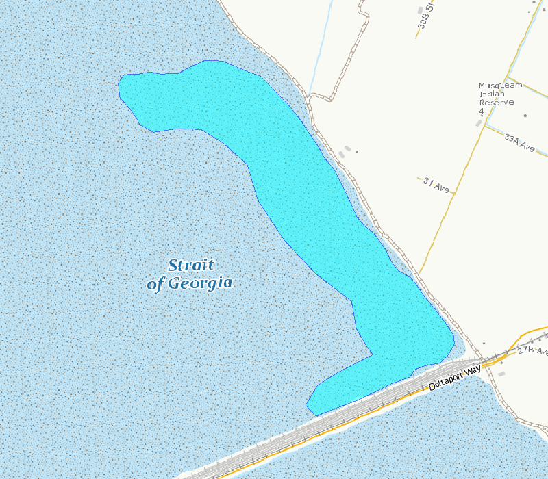
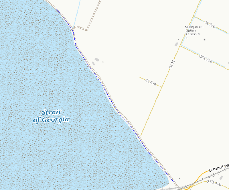
Survey points is a point feature class containing transects and observations completed in 2011.
-
This database contains detailed information on various sorbents (materials used to absorb chemicals) with a particular emphasis on the compunds abilities to absorb oil from tanker spills.
-
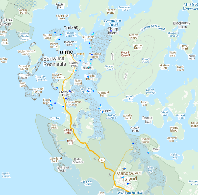
This polygon outlines the basic area included in the survey counts. This area is the best approximation of the mudflat that can be surveyed from shore and is exposed at tide tide height of 3.5 m, based on tidal predictions at Point Atkinson, British Columbia.
-
This line outlines the basic survey route included in the survey counts. This route is the best access to areas that can be surveyed from shore.
-
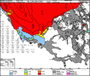
The Canadian Ice Service maintains a collection of Daily ice charts, Regional ice charts and Iceberg charts. These charts are available in GIF format and E00 (Regional Charts only).
-

This dataset provides geospatial polygon boundaries for marine bivalve shellfish harvest area classification in Newfoundland and Labrador, Canada. These data represent the five classification categories of marine bivalve shellfish harvest areas (Approved; Conditionally Approved; Restricted; Conditionally Restricted; and Prohibited) under the Canadian Shellfish Sanitation Program (CSSP). Data are collected by Environment and Climate Change Canada (ECCC) for the purpose of making applicable classification recommendations on the basis of sanitary and water quality survey results. ECCC recommendations are reviewed and adopted by Regional Interdepartmental Shellfish Committees prior to regulatory implementation by Fisheries and Oceans Canada (DFO). These geographic data are for illustrative purposes only; they show shellfish harvest area classifications when in Open Status. The classification may be superseded at any time by regulatory orders issued by DFO, which place areas in Closed Status, due to conditions such as sewage overflows or elevated biotoxin levels. For further information about the current status and boundary coordinates for areas under Prohibition Order, please contact your local DFO office.
-

This dataset provides geospatial polygon boundaries for marine bivalve shellfish harvest area classification in New Brunswick, Canada. These data represent the five classification categories of marine bivalve shellfish harvest areas (Approved; Conditionally Approved; Restricted; Conditionally Restricted; and Prohibited) under the Canadian Shellfish Sanitation Program (CSSP). Data are collected by Environment and Climate Change Canada (ECCC) for the purpose of making applicable classification recommendations on the basis of sanitary and water quality survey results. ECCC recommendations are reviewed and adopted by Regional Interdepartmental Shellfish Committees prior to regulatory implementation by Fisheries and Oceans Canada (DFO). These geographic data are for illustrative purposes only; they show shellfish harvest area classifications when in Open Status. The classification may be superseded at any time by regulatory orders issued by DFO, which place areas in Closed Status, due to conditions such as sewage overflows or elevated biotoxin levels. For further information about the current status and boundary coordinates for areas under Prohibition Order, please contact your local DFO office.