
1871
Type of resources
Topics
Keywords
Provided by
Years
Formats
Representation types
Update frequencies
status
-
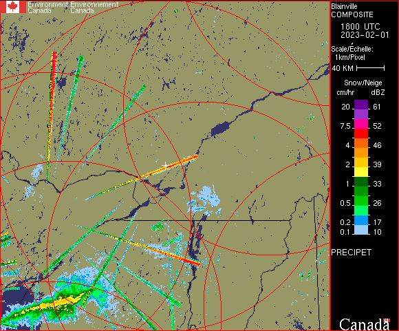
The PRECIP-ET (PRECIPET on images) is an extension of the PRECIP product (hence the use of ET in the product name). Compared to the previous PRECIP product, the PRECIP-ET performs a suite of additional quality control (QC) tests and tracks issues better. For example, Doppler filters might be rejecting moderate ground echoes in a particular area and thus weak meteorological echoes would not be detectible. In this case, PRECIP-ET would flag the missing data area, whereas PRECIP would simply treat the area as no echoes. This additional quality treatment is why we have migrated to PRECIP-ET in 2013, to get an improved service. The PRECIP-ET image is designed to show the precipitation close to the ground, by using Doppler technology processing for echoes within 128 km from the radar site for the C-Band radars and 240 km for the new S-Band radars. Doppler technology allows for better resolution of the precipitation echoes and also provides the ability to detect the movement of precipitation in relation to the radar (i.e. are the raindrops or snowflakes moving towards or away from the radar and at what speed). Beyond this 128 km limit, the echoes are displayed using the more conventional CAPPI processing.
-
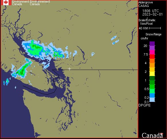
DPQPE product: DPQPE stands for: Dual Polarization Quantitative Precipitation Estimation. The DPQPE product is available only for S-Band radars. It is a two-dimensional representation of the precipitation rate estimated by the lowest sweep of the radar (elevation angle of 0.4 degrees for the majority of S-Band radars). Thus, the precipitation rate is estimated as close to the earth's surface as possible. The DPQPE product is based, among other things, on a series of polarimetric processing steps (quality control) to eliminate non-meteorological artifacts from the raw data (volumetric scans). It renders in mm/h for rain and cm/h for snow. This product is calculated with a maximum coverage range of 240 km.
-
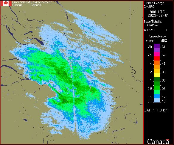
Due to the curvature of the Earth, the height of a radar beam, in relation to the ground, increases as it travels further from the radar. When the radar is pointed down near the ground (a low elevation angle), the beam starts off near the ground but then its height above the ground slowly increases. By the time that same beam is 200 km from the radar, it is at a height of around 4 km above the ground. In order to get a better sense of what is happening at one approximate height above the ground (i.e. 1.5 km), a whole series of radar beams with different elevation angles (low, medium, high) are used to create one radar product. This type of radar product is called a CAPPI (Constant Altitude Plan Position Indicator). Since the CAPPI products do not use Doppler processing to filter out clutter like tall trees, hills and buildings, it can sometimes be contaminated by non meteorological echoes.
-
Environment Canada issues weather alerts about weather related hazards in order to notify those in affected areas so that they can take steps to protect themselves and their property from harm. Alerts are classified depending on the severity and timing of the subject event and include: warnings, watches, advisories and statements. Warnings are usually issued six to 24 hours in advance, although some severe weather (such as thunderstorms and tornadoes) can occur rapidly, with less than a half hours' notice.
-
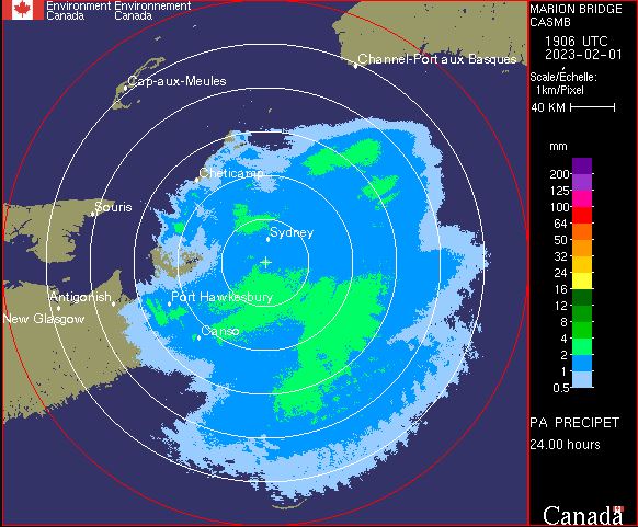
This product shows the rain accumulation, in mm, over the last 24 hour period based on PRECIP-ET and DPQPE. For PRECIP-ET, this product is available every 10 minutes for C-Band radars and every 6 minutes for S-Band radars. For DPQPE, this product is available every 6 minutes.