RI_594
Type of resources
Topics
Keywords
Contact for the resource
Provided by
Years
Formats
Representation types
Update frequencies
status
-

The monthly mean is the average of daily mean values for a given month.
-

The daily mean is the average of all unit values for a given day.
-
This notice applies to owners of facilities that manufacture or use greater than 100 kg of bisphenol A per year (alone or in a mixture), release effluents containing bisphenol A, and are involved in the activities specified in the notice. This notice has been in effect since April 14, 2012, for facilities who manufacture or use BPA. Although the initial facilities subject have completed their obligations, this notice is still in effect. This means that new facilities could become subject if they meet the requirement(s) of the notice. For more information, please refer to the Notice link provided below.
-
Archived population trend estimates, based on data collected through the North American Breeding Bird Survey (BBS), for approximately 300 Canadian bird species. These archived estimates use data from Canadian BBS routes only, collected from 1970 through 2011. Trends are presented for species, provinces, territories, Bird Conservation Regions (BCR), as well as the sub-regions that make up the analytical strata (intersections of BCRs and provinces/territories), for which there are sufficient BBS data for statistical analysis. These estimates were produced using a hierarchical Bayesian model, which differs from the maximum likelihood model that was used to generate BBS trend estimates from 2002 through 2009. Further details on the statistical methods used to produce these estimates is available in the downloadable word documents. The BBS is jointly coordinated by Environment Canada, Canadian Wildlife Service and the U.S. Geological Survey (USGS), Patuxent Wildlife Research Center. Any use of these BBS results for Canada should acknowledge the hundreds of skilled volunteers in Canada who have participated in the BBS over the years and those who have served as provincial or territorial coordinators for the BBS.
-

Anomalous weather resulting in Temperature and Precipitation extremes occurs almost every day somewhere in Canada. For the purpose of identifying and tabulating daily extremes of record for temperature, precipitation and snowfall, the Meteorological Service of Canada has threaded or put together data from closely related stations to compile a long time series of data for about 750 locations in Canada to monitor for record-breaking weather. Virtual Climate stations correspond with the city pages of weather.gc.ca. This data provides the daily extremes of record for Snowfall for each day of the year. Daily elements include: Greatest Snowfall.
-
Pollution Prevention (P2) Planning Notices published in the Canada Gazette under the Canadian Environmental Protection Act, 1999 (CEPA) legally require persons subject to the Notice to prepare and implement a pollution prevention plan in respect of a specified substance(s). Environment and Climate Change Canada receives P2 Notice reports which contain information on the P2 plans implemented by facilities as well as the results achieved. Information submitted is publicly available except for parts where confidentiality requests were accepted. The data for each P2 Planning Notice listed alphabetically below is provided in a csv format. Note that reports received for active P2 Planning Notices are searchable via the Online Search of the P2 Planning Reporting Tool.
-

A station is a site on a river or lake where water quantity (water level and flow) are collected and recorded.
-

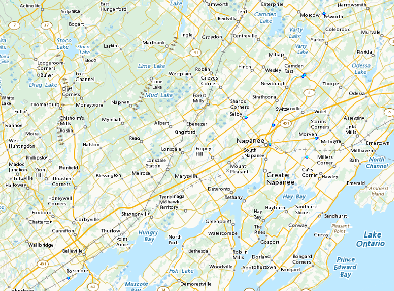
The Bay of Quinte is a long and narrow "Z" shaped inlet located on the northern shore of Lake Ontario. The bay and the surrounding drainage basin were listed as an Area of Concern in 1987 under the GLWQA as 10 of the 14 beneficial use indicators of ecosystem health were deemed impaired. Excess nutrient runoff from agricultural lands, wastewater treatment plants and storm water contributed to extensive algae growth; one of the biggest challenges of the Bay of Quinte Remedial Action Plan was the management of phosphorus loads into the watershed. The goal of this project is to determine the effect of extreme rain events versus base flow on the nutrient levels for two tributaries flowing into the Bay of Quinte. Water quality data and water movement data will contribute towards a knowledge base for evaluating the status of and delisting Bay of Quinte as an Area of Concern, as well as provide a measure of the ecological response to remedial efforts. The data are phosphorus concentrations at the Bay of Quinte (Ontario) for 10 stations from 2015 to 2018.
-
This notice applied to owners of facilities involved in certain activities and that used 1000 kg or more of dichloromethane per year. This notice was in effect from November 29, 2003, to December 31, 2005, for persons involved in pharmaceuticals and chemical intermediates manufacturing and tablet coating, and adhesives formulation. This notice was also in effect from November 29, 2003 to May 31, 2008 for persons involved in aircraft paint stripping, including the stripping of aircraft components, for flexible polyurethane foam blowing, and for industrial cleaning. It is now completed. For more information please refer to the Notice link provided below.
-
This notice applies to owners of facilities that manufacture or use greater than 100 kg of siloxane D4 per year (alone or in a mixture), release effluents containing siloxane D4, and are involved in the activities specified in the notice. This notice has been in effect since June 2, 2012, for facilities who manufacture or use siloxane D4. Although the initial facilities subject have completed their obligations this notice is still in effect. This means that new facilities could become subject if they meet the requirement(s) of the notice. For more information please refer to the Notice link provided below.
