
society
Type of resources
Topics
Keywords
Contact for the resource
Provided by
Years
Formats
Representation types
Update frequencies
status
-
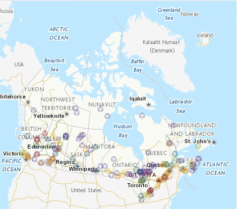
The 2012 Canadian Nature Survey is part of a series of national surveys on the importance of nature to Canadians. The purpose of the survey is to provide reliable, current information about Canadians’ awareness of nature related concepts, their decisions related to nature, and their involvement in nature-based activities. The 2012 edition updates and expands on information provided by Canadians in the 1996 Survey on the Importance of Nature to Canadians, and the 1981, 1987, and 1991 surveys on the Importance of Wildlife to Canadians. The 2012 Canadian Nature Survey was developed through active collaboration between the federal government and all 13 provincial and territorial governments. During 2012 and 2013 the survey was administered to a nationally representative sample of approximately 15,000 Canadian adults and a selection of nearly 9,000 Web panelists. Data collection consisted of: 1) A mail survey with a Web response option administered to a random sample of residential addresses in Canada stratified by province and territory (excluding Nunavut) and urban versus rural location; 2) A Web survey administered to Web panelists who were recruited to complete the survey by a third party; 3) An opt-in supplement in the Northwest Territories where local Department of Environment and Natural Resources officials: a) contacted a small number of potential respondents, provided an electronic version of the survey, and asked for their participation; and b) provided hard copy versions of the survey at Department offices; 4) An opt-in community-based survey in Nunavut involving door-to-door administration, using paper-based data collection instruments. The survey was offered in English, French, and Inuktitut (in Nunavut). You are encouraged to read the report on the results of the 2012 Canadian Nature Survey, which can be downloaded free of charge from www.biodivcanada.ca. In particular, please review the section entitled Survey Methods which provides detailed descriptions of the sampling approach, the numbers of respondents by geographic and demographic category, the data collection process, the weighting applied to the different samples, and advice on using the data for further analysis. The 2012 Canadian Nature Survey questionnaire is provided as a separate file and is reproduced in the above report in Appendix B: Survey Instrument. The dataset provided is a public use microdata file. Please review the data user's guide provided which contains information on applying weights to the records in the dataset, comparison with previously published results, and the disclosure control strategy applied to the data.
-
The Canadian Environmental Sustainability Indicators (CESI) program provides data and information to track Canada's performance on key environmental sustainability issues. The Sustainability of timber harvest indicator compares the amount of timber harvested with the estimated wood supply. Wood supply is the volume of timber that can be harvested from an area over a specified period of time while meeting environmental, economic and social objectives. In the indicator, wood supply refers to industrial roundwood supplies only and does not include other types of harvest. The indicator supports the measurement of progress towards the following 2019 to 2022 Federal Sustainable Development Strategy target: "Between now and 2022, maintain Canada’s annual timber harvest at or below sustainable wood supply levels." Information is provided to Canadians in a number of formats including: static and interactive maps, charts and graphs, HTML and CSV data tables and downloadable reports. See the supplementary documentation for the data sources and details on how the data were collected and how the indicator was calculated.
-
The Canadian Environmental Sustainability Indicators (CESI) program provides data and information to track Canada's performance on key environmental sustainability issues. These indicators present the concentrations of 4 substances (mercury, lead, cadmium and bisphenol A) in Canadians for the periods 2007 to 2009, 2009 to 2011, 2012 to 2013, and 2014 to 2015. Chemical substances are everywhere, including in the air, soil, water, products and food, and can enter the body through ingestion, inhalation and skin contact. Through biomonitoring, the government can identify priorities, develop or revise risk management strategies, and track progress on policies put in place to reduce or control these substances. Information is provided to Canadians in a number of formats including: static and interactive maps, charts and graphs, HTML and CSV data tables and downloadable reports. See the supplementary documentation for the data sources and details on how the data were collected and how the indicator was calculated.
-
The Canadian Environmental Sustainability Indicators program provides data and information to track Canada's performance on key environmental sustainability issues. The Polybrominated diphenyl ethers in fish and sediment indicators identify the drainage regions where concentrations are below or above the Federal Environmental Quality Guidelines (the guidelines) for polybrominated diphenyl ethers (PBDEs) in fish and sediment. The guidelines were developed under the Chemicals Management Plan and are used in this report to evaluate whether, and the degree to which, concentrations in the environment exceed the guidelines. These indicators provide information on the presence of PBDEs in the environment and on the progress of strategies and policies to reduce or control their occurrence in the environment. Information is provided to Canadians in a number of formats including: static and interactive maps, charts and graphs, HTML and CSV data tables and downloadable reports. See the supplementary documentation for the data sources and details on how the data were collected and how the indicator was calculated. Information is provided to Canadians in a number of formats including: static and interactive maps, charts and graphs, HTML and CSV data tables and downloadable reports. See the supplementary documentation for the data sources and details on how the data were collected and how the indicator was calculated.
-
The Canadian Environmental Sustainability Indicators (CESI) program provides data and information to track Canada's performance on key environmental sustainability issues. The Phosphorus and nitrogen levels in Lake Winnipeg indicator reports on the status of total phosphorus and total nitrogen levels in Lake Winnipeg and its 3 largest tributaries: the Red, Saskatchewan and Winnipeg rivers. The indicator assumes that water in the region would never be above phosphorus and nitrogen water quality criteria or objectives in the absence of human development. It provides information about how human activity contributes to phosphorus and nitrogen levels in lakes and rivers. The phosphorus and nitrogen status in Lake Winnipeg is established by comparing phosphorus and nitrogen levels to water quality objectives. Failure to meet a water quality objective suggests a greater risk to the health of the lake ecosystem. In rivers, phosphorus and nitrogen status is determined by the frequency with which a water quality objective is exceeded. The more often the criteria or objective is exceeded, the greater the risk to the health of the river ecosystems. Information is provided to Canadians in a number of formats including: static and interactive maps, charts and graphs, HTML and CSV data tables and downloadable reports. See the supplementary documentation for the data sources and details on how the data were collected and how the indicator was calculated.
-
The Canadian Environmental Sustainability Indicators (CESI) program provides data and information to track Canada's performance on key environmental sustainability issues. The International comparison: air pollutant emissions in selected countries indicators provide emissions and emissions intensity for member countries of the Organisation for Economic Co-operation and Development. The emissions of 5 pollutants are reported: sulphur oxides, nitrogen oxides, carbon monoxide, volatile organic compounds and fine particulate matter. These indicators help to inform Canadians about how Canada's emissions compare to those of other countries. The indicators report on key air pollutants that contribute to smog and acid rain and help the government to identify priorities, track progress, and develop strategies and policies for reducing or controlling air pollution. Information is provided to Canadians in a number of formats including: static and interactive maps, charts and graphs, HTML and CSV data tables and downloadable reports. See the supplementary documentation for the data sources and details on how the data were collected and how the indicator was calculated.
-
The Canadian Environmental Sustainability Indicators (CESI) program provides data and information to track Canada's performance on key environmental sustainability issues. The Releases of harmful substances to water indicators track facility-based releases to water of 3 substances that are defined as toxic under the Canadian Environmental Protection Act, 1999: mercury, lead and cadmium and their compounds. For each substance, data are provided at the national, regional (provincial and territorial) and facility level and by source. The indicators inform Canadians about releases to water of these 3 substances from facilities in Canada. The Releases of harmful substances to water indicators also help the government to identify priorities and develop or revise strategies to inform further risk management and to track progress on policies put in place to reduce or control these 3 substances and water pollution in general. Information is provided to Canadians in a number of formats including: static and interactive maps, charts and graphs, HTML and CSV data tables and downloadable reports. See the supplementary documentation for the data sources and details on how the data were collected and how the indicator was calculated. Canadian Environmental Sustainability Indicators: https://www.canada.ca/environmental-indicators
-
The Canadian Environmental Sustainability Indicators (CESI) program provides data and information to track Canada's performance on key environmental sustainability issues. The Pulp and paper effluent quality indicator reports the percentage of toxicity, biochemical oxygen demand and total suspended solid tests that are within the regulatory limits for selected years between 1985 and 2017. The Pulp and Paper Effluent Regulations (the regulations) were developed under the Fisheries Act in 1971 to govern the discharge of deleterious substances into waters frequented by fish. Information is provided to Canadians in a number of formats including: static and interactive maps, charts and graphs, HTML and CSV data tables and downloadable reports. See the supplementary documentation for the data sources and details on how the data were collected and how the indicator was calculated.
-
The Canadian Environmental Sustainability Indicators (CESI) program provides data and information to track Canada's performance on key environmental sustainability issues.These indicators present the concentrations of 4 substances (mercury, lead, cadmium and bisphenol A) in the Canadian population for the 6 survey cycles from 2007 to 2019 based on data collected as part of the Canadian Health Measures Survey. These substances were chosen from the Canadian Health Measures Survey because they complement other indicators from the Canadian Environmental Sustainability Indicators program. For each substance, the concentration in blood or urine is provided by age group and by sex when data are available. The Government of Canada uses a variety of methods, tools and models to assess human exposure to environmental chemicals and their potential health effects. Human exposure to chemicals can be estimated indirectly by measuring chemicals in the environment, food or products, or directly by biomonitoring. The Canadian Health Measures Survey measures environmental chemicals and/or their metabolites in blood and urine of participants. These indicators provide a snapshot of the survey results. Information is provided to Canadians in a number of formats including: static and interactive maps, charts and graphs, HTML and CSV data tables and downloadable reports. See the supplementary documentation for the data sources and details on how the data were collected and how the indicator was calculated. Canadian Environmental Sustainability Indicators: https://www.canada.ca/environmental-indicators
-
The Canadian Environmental Sustainability Indicators (CESI) program provides data and information to track Canada's performance on key environmental sustainability issues. The Perfluorooctane sulfonate in fish and water indicators provide information on the presence of perfluorooctane sulfonate (PFOS) in the environment and indications of the progress of strategies and policies to reduce or control their occurrence in the environment. These indicators identify the drainage regions where concentrations are below or above the Federal Environmental Quality Guidelines for PFOS in fish and water. Information is provided to Canadians in a number of formats including: static and interactive maps, charts and graphs, HTML and CSV data tables and downloadable reports. See the supplementary documentation for the data sources and details on how the data were collected and how the indicator was calculated.