
JSON
Type of resources
Topics
Keywords
Contact for the resource
Provided by
Years
Formats
Representation types
Update frequencies
status
-
Survey points is a point feature class containing transects and observations completed in 2011.
-
In the face of increasing economic opportunities in Canada's northern regions, the need to improve our state of preparedness for oil spill related emergencies in particular is critical. While significant efforts have been put towards documenting baseline coastal information across Canada’s southern regions, there is a large information gap regarding Arctic shorelines. Baseline coastal information such as shoreline form, substrate and vegetation type, is required for operational prioritization, coordination of on-site spill response activities (i.e., SCAT: Shoreline Cleanup and Assessment Technique), as well as providing valuable information for wildlife and ecosystem management. A standardized methodology was developed to map shoreline characteristics at six study sites across the Canadian Arctic: James Bay, Resolute Bay, Hudson Bay, Labrador Coast, Victoria Strait, and Beaufort Sea. Geo-referenced high definition videography was collected during the summers of 2010 to 2012 along coastlines within the study sites. Detailed information (i.e. shoreline type, substrate, form, height, slope, fetch, access type, exposure, etc.) describing the upper intertidal, supratidal, and backshore zones was extracted from the video and entered into a geospatial database using a data collection form. This information was used to delimit and map alongshore segments in the upper intertidal zone. The result is a vector dataset containing thousands of linear shoreline segments ranging in length from 200 m and 2 km long. In total, almost seven thousand kilometers of northern shorelines were mapped, including twenty five different shoreline types based on the upper intertidal zone. This information will feed into a larger ongoing project focused on Arctic coastal ecosystems as well as serve as valuable information for oil spill response planning should the need arise. This database also provides valuable information for habitat management, local shoreline planning, can feed into environmental assessments or be used to aid research site selection.
-
Survey areas is a polygon feature class containing mudflats and staging areas observed for shorebirds.
-
Survey transects is a line feature class containing transects completed in 2011.
-
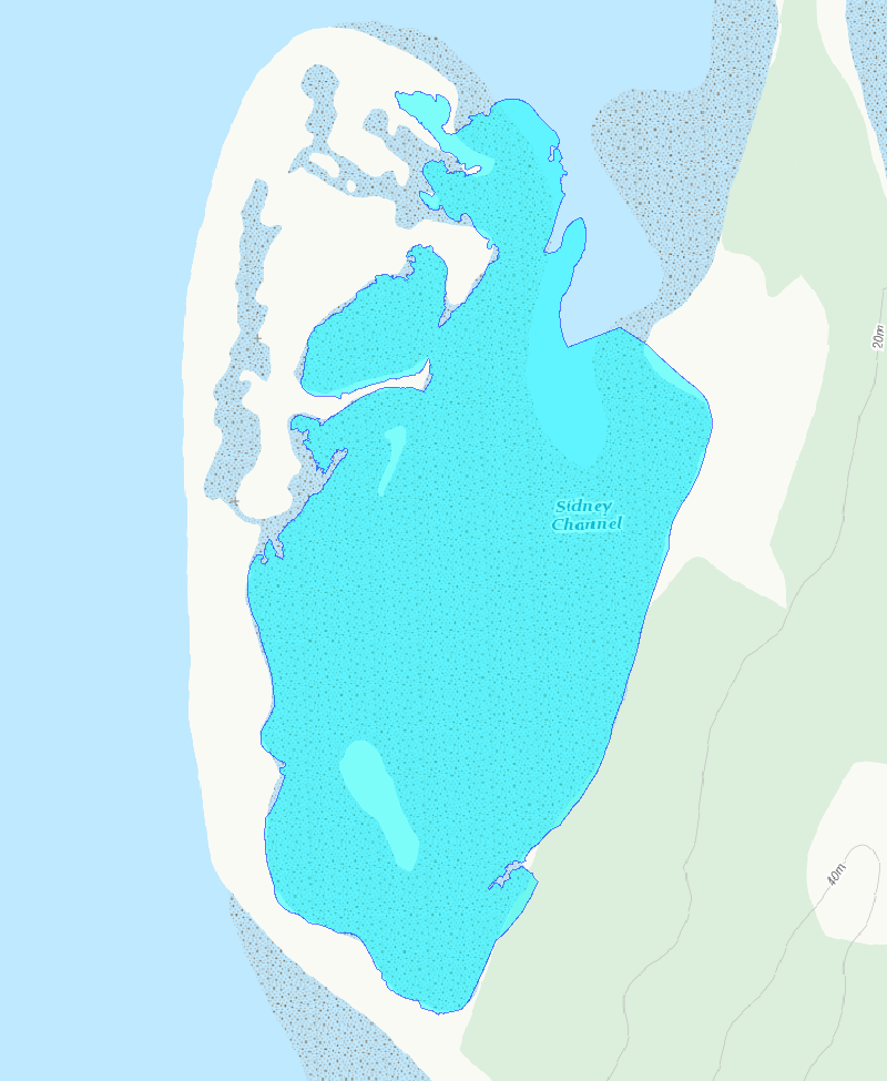
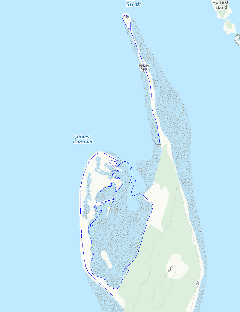
Sidney Island Shorebird Surveys transects area feature.
-
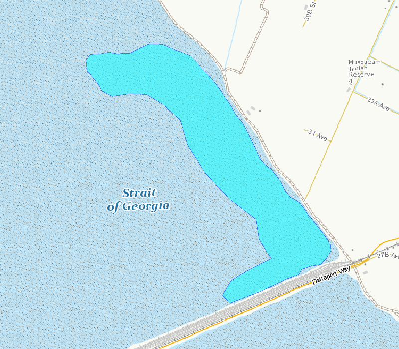
This polygon outlines the basic area included in the survey counts. This area is the best approximation of the mudflat that can be surveyed from shore and is exposed at tide tide height of 3.5 m, based on tidal predictions at Point Atkinson, British Columbia.
-
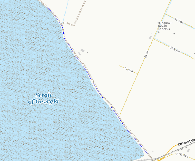
This line outlines the basic survey route included in the survey counts. This route is the best access to areas that can be surveyed from shore.
-
Surveyor shorebird bird observations and counts for all years.
-
Sidney Island Shorebirds Survey peep counts.
-
Sidney Island Shorebirds Survey transects line feature.