
oceans
Type of resources
Topics
Keywords
Contact for the resource
Provided by
Years
Formats
Representation types
Update frequencies
status
-

The North Coast of British Columbia dataset is part of Environment and Climate Change Canada’s Shoreline Classification and Pre-Spill database. Shoreline segmentation data has been developed for use by the Environmental Emergencies Program of Environment and Climate Change Canada for environmental protection purposes. Marine shorelines are classified according to the character (substrate and form) of the upper intertidal (foreshore) or upper swash zone (Sergy, 2008). This is the area where oil from a spill usually becomes stranded and where treatment or cleanup activities take place. The basic parameter that defines the shoreline type is the material that is present in the intertidal zone. The presence or absence of sediments is a key factor in determining whether oil is stranded on the surface of a substrate or can penetrate and/or be buried. This dataset contains thousands of linear shoreline segments ranging in length from 200 m and 2 km long. The entities represent the location of the segments and their geomorphological description. Overflights have been carried out for the segments of the west coast of Haida Gwaii. These new features will soon be updated to the current dataset. There exist further fields in the attribute table for this dataset. We are currently working on standardizing our shoreline segmentation datasets and the updated data will soon be uploaded to the catalog. Sergy, G. (2008). The Shoreline Classification Scheme for SCAT and Oil Spill Response in Canada. Proceedings of the 31stArctic and Marine Oil Spill Program Technical Seminar.Environment Canada, Ottawa, ON, Pp. 811-819.
-
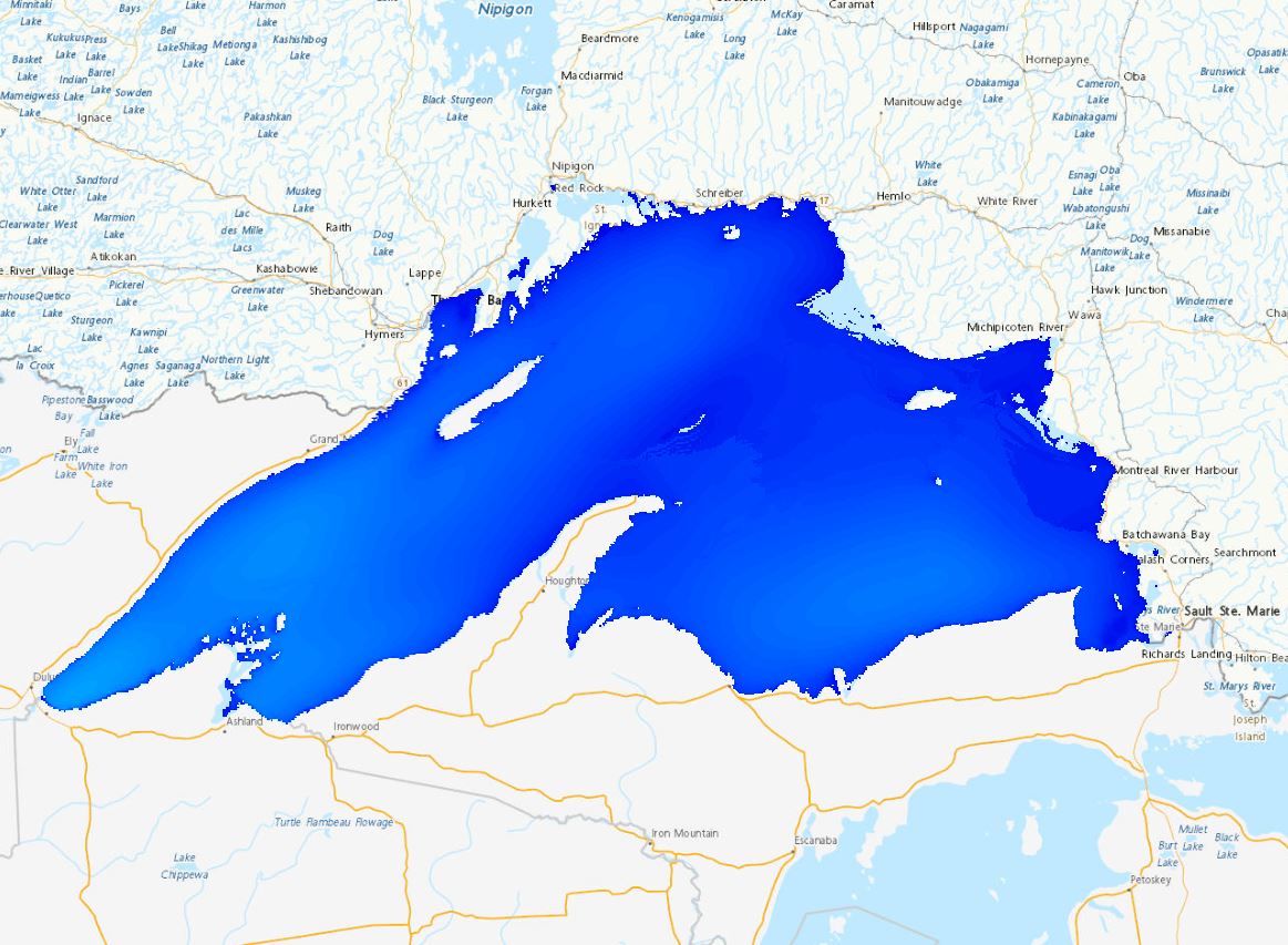
The Regional Deterministic Wave Prediction System (RDWPS) produces wave forecasts out to 48 hours in the future using the third generation spectral wave forecast model WaveWatch III® (WW3). The model is forced by the 10 meters winds from the High Resolution Deterministic Prediction System (HRDPS). Over the Great Lakes, an ice forecast from the Water Cycle Prediction System of the Great Lakes (WCPS) is used by the model to attenuate or suppress wave growth in areas covered by 25% to 75% and more than 75% ice, respectively. Over the ocean, an ice forecast from the Regional Ice Ocean Prediction System (RIOPS) is used: in the Northeast Pacific, waves propagate freely for ice concentrations below 50%, above this threshold there is no propagation; in the Northwest Atlantic the same logic is used as in the Great Lakes. Forecast elements include significant wave height, peak period, partitioned parameters and others. This system includes several domains: Lake Superior, Lake Huron-Michigan, Lake Erie, Lake Ontario, Atlantic North-West and Pacific North-East.
-
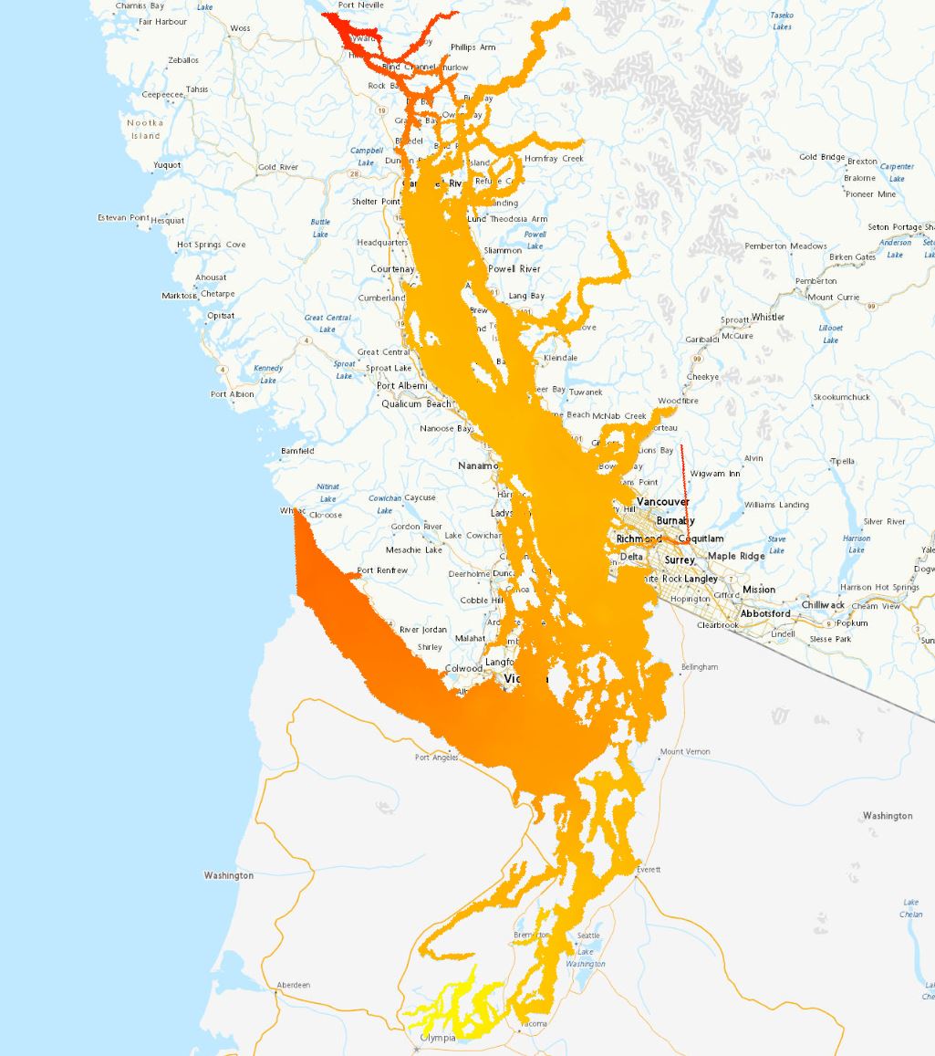
The Coastal Ice-Ocean Predicton System (CIOPS) provides a 48 hour ocean and ice forecast over different domains (East, West, Salish Sea) four times a day at 1/36° resolution. A pseudo-analysis component is forced at the ocean boundaries by the Regional Ice-Ocean Prediction System (RIOPS) forecasts and spectrally nudged to the RIOPS solution in the deep ocean. Fields from the pseudo-analysis are used to initialize the 00Z forecast, whilst the 06, 12 and 18Z forecasts use a restart files saved at hour 6 from the previous forecast. The atmospheric fluxes for both the pseudo-analysis and forecast components are provided by the High Resolution Deterministic Prediction System (HRDPS) blended both spatially and temporally with either the Global Deterministic Prediction System (GDPS) (for CIOPS-East) or the Regional Deterministic Predicton System (RDPS) (for CIOPS-West) for areas not covered by the HRDPS.
-
This collection holds the layers used for the "Map of Upper Intertidal shoreline segmentation with Shoreline Cleanup Assessment Technique (SCAT) classification", a WMS service maintained by ECCC. The segmentation covers shorelines for Northern Canada, the North coast of British Columbia, as well as Ontario, Quebec, and Atlantic regions.
-
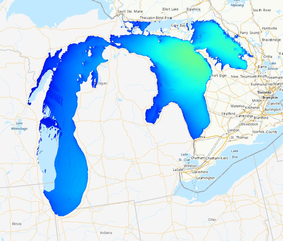
The Regional Deterministic Wave Prediction System (RDWPS) produces wave forecasts out to 48 hours in the future using the third generation spectral wave forecast model WaveWatch III® (WW3). The model is forced by the 10 meters winds from the High Resolution Deterministic Prediction System (HRDPS). Over the Great Lakes, an ice forecast from the Water Cycle Prediction System of the Great Lakes (WCPS) is used by the model to attenuate or suppress wave growth in areas covered by 25% to 75% and more than 75% ice, respectively. Over the ocean, an ice forecast from the Regional Ice Ocean Prediction System (RIOPS) is used: in the Northeast Pacific, waves propagate freely for ice concentrations below 50%, above this threshold there is no propagation; in the Northwest Atlantic the same logic is used as in the Great Lakes. Forecast elements include significant wave height, peak period, partitioned parameters and others. This system includes several domains: Lake Superior, Lake Huron-Michigan, Lake Erie, Lake Ontario, Atlantic North-West and Pacific North-East.
-
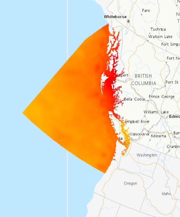
The Coastal Ice-Ocean Predicton System (CIOPS) provides a 48 hour ocean and ice forecast over different domains (East, West, Salish Sea) four times a day at 1/36° resolution. A pseudo-analysis component is forced at the ocean boundaries by the Regional Ice-Ocean Prediction System (RIOPS) forecasts and spectrally nudged to the RIOPS solution in the deep ocean. Fields from the pseudo-analysis are used to initialize the 00Z forecast, whilst the 06, 12 and 18Z forecasts use a restart files saved at hour 6 from the previous forecast. The atmospheric fluxes for both the pseudo-analysis and forecast components are provided by the High Resolution Deterministic Prediction System (HRDPS) blended both spatially and temporally with either the Global Deterministic Prediction System (GDPS) (for CIOPS-East) or the Regional Deterministic Predicton System (RDPS) (for CIOPS-West) for areas not covered by the HRDPS.
-

The Quebec—Saint-Lawrence River dataset is part of Environment and Climate Change Canada’s Shoreline Classification and Pre-Spill database. Shoreline classification data has been developed for use by the Environmental Emergencies Program of Environment and Climate Change Canada for environmental protection purposes. Marine and freshwater shorelines are classified according to the character (substrate and form) of the upper intertidal (foreshore) or upper swash zone (Sergy, 2008). This is the area where oil from a spill usually becomes stranded and where the treatment or cleanup activities take place. The basic parameter that defines the shoreline type is the material that is present in the intertidal zone. The presence or absence of sediments is a key factor in determining whether oil is stranded on the surface of a substrate or can penetrate and/or be buried. This dataset contains thousands of linear shoreline segments ranging in length from 200 m and 2 km long. The entities represent the location of the segments and their geomorphological description. There exist further fields in the attribute table for this dataset. We are currently working on standardizing our shoreline segmentation datasets and the updated data will soon be uploaded to the catalog. Sergy, G. (2008). The Shoreline Classification Scheme for SCAT and Oil Spill Response in Canada. Proceedings of the 31stArctic and Marine Oil Spill Program Technical Seminar.Environment Canada, Ottawa, ON, Pp. 811-819.
-
The Global Ice-Ocean Prediction System (GIOPS) produces global sea ice and ocean analyses and 10 day forecasts daily. This product contains time-mean sea ice and ocean forecast fields interpolated to two grids. One of the grids is a 0.2° resolution regular latitude-longitude grid covering the global ocean (north of 80° S). The other grid is in north-polar stereographic projection with a 5-km spacing at the standard parallel 60° N and covers the Arctic Ocean and the neighbouring sub-polar seas. Data is available for 50 depths. The data files are in netCDF format and comply with the Climate and Forecast Conventions.
-
The Global Deterministic Wave Prediction System (GDWPS) produces wave forecasts out to 120 hours in the future using the third generation spectral wave forecast model WaveWatch III® (WW3). The model is forced by the 10 meters winds and the ice concentration from the Global Deterministic Prediction System (GDPS). The ice concentration is used by the model to attenuate wave growth in areas covered by 25% to 75% ice and to suppress it for concentration above 75%. Forecast elements include significant wave height, peak period and primary swell height, direction and period.
-

The Atlantic dataset is part of Environment and Climate Change Canada’s Shoreline Classification and Pre-Spill database. Shoreline classification data has been developed for use by the Environmental Emergencies Program of Environment and Climate Change Canada for environmental protection purposes. Marine and estuarine shorelines are classified according to the character (substrate and form) of the upper intertidal (foreshore) or upper swash zone (Sergy, 2008). This is the area where oil from a spill usually becomes stranded and where treatment or cleanup activities take place. The basic parameter that defines the shoreline type is the material that is present in the intertidal zone. The presence or absence of sediments is a key factor in determining whether oil is stranded on the surface of a substrate or can penetrate and/or be buried. This dataset contains thousands of linear shoreline segments ranging in length from 200 m and 2 km long. The entities represent the location of the segments and their geomorphological description. There exist further fields in the attribute table for this dataset. We are currently working on standardizing our shoreline segmentation datasets and the updated data will soon be uploaded to the catalog. Sergy, G. (2008). The Shoreline Classification Scheme for SCAT and Oil Spill Response in Canada. Proceedings of the 31stArctic and Marine Oil Spill Program Technical Seminar.Environment Canada, Ottawa, ON, Pp. 811-819.