
1987
Type of resources
Topics
Keywords
Contact for the resource
Provided by
Years
Formats
Representation types
Update frequencies
status
-
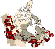
The Canadian Aquatic Biomonitoring Network (CABIN) is an aquatic biomonitoring program for assessing the health of fresh water ecosystems in Canada. Benthic macroinvertebrates are collected at a site location and their counts are used as an indicator of the health of that water body. CABIN is based on the network of networks approach that promotes inter-agency collaboration and data-sharing to achieve consistent and comparable reporting on fresh water quality and aquatic ecosystem conditions in Canada. The program is maintained by Environment and Climate Change Canada (ECCC) to support the collection, assessment, reporting and distribution of biological monitoring information. A set of nationally standardized CABIN protocols are used for field collection, laboratory work, and analysis of biological monitoring data. A training program is available to certify participants in the standard protocols. There are two types of sites in the CABIN database (reference and test). Reference sites represent habitats that are closest to “natural” before any human impact. The data from reference sites are used to create reference models that CABIN partners use to evaluate their test sites in an approach known as the Reference Condition Approach (RCA). Using the RCA models, CABIN partners match their test sites to groups of reference sites on similar habitats and compare the observed macroinvertebrate communities. The extent of the differences between the test site communities and the reference site communities allows CABIN partners to estimate the severity of the impacts at those locations. CABIN samples have been collected since 1987 and are organized in the database by study (partner project). The data is delineated by the 11 major drainage areas (MDA) found in Canada and each one has a corresponding study, habitat and benthic invertebrate data file. Links to auxiliary water quality data are provided when available. Visits may be conducted at the same location over time with repeat site visits being identified by identical study name / site code with different dates. All data collected by the federal government is available on Open Data and more partners are adding their data continually. The csv files are updated monthly. Contact the CABIN study authority to request permission to access non open data.
-
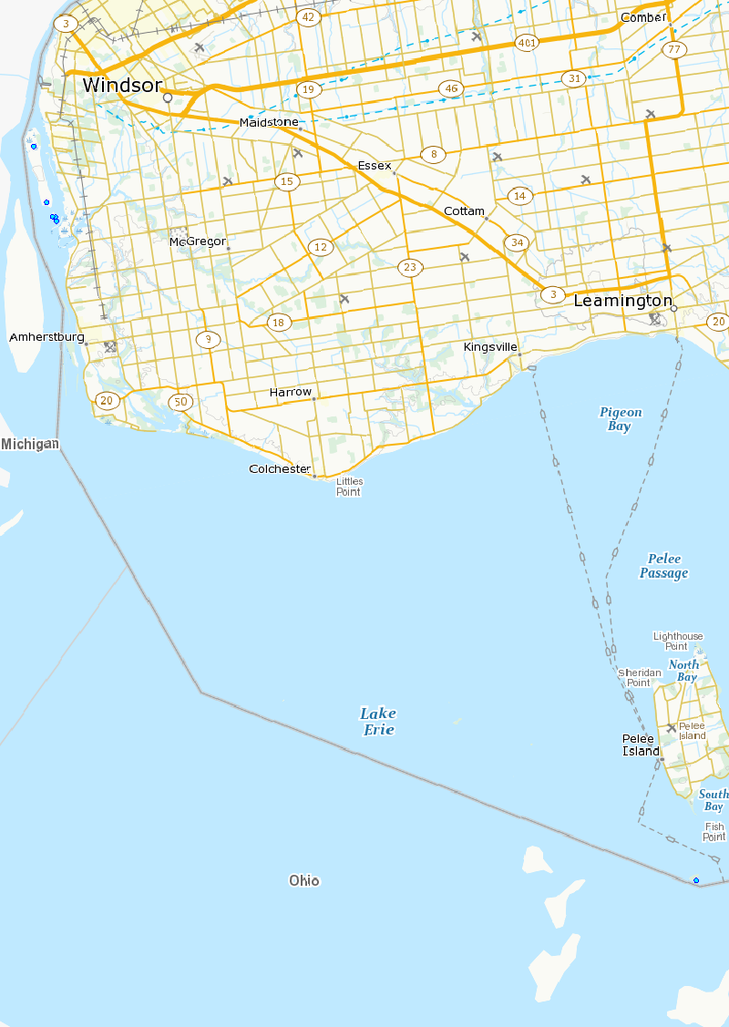
An Area of Concern (AOC) is a location where environmental quality is degraded compared to other areas in the Great Lake Basin resulting in the impairment of beneficial uses. A total of 43 AOCs were identified as a result of Annex 2 of the Great Lakes Water Quality Agreement (GLWQA).The Canada-United States GLWQA identifies 14 beneficial uses that must be restored in order to remove the designation as an Area of Concern. A beneficial use is defined as the ability of living organisms (including humans) to use the Great Lakes Basin Ecosystem without adverse consequences. A Beneficial Use Impairment (BUI) is a condition that interferes with the enjoyment of a water use. Each BUI has a set of locally-defined delisting criteria that are specific, measurable, achievable, and scientifically-defensible. The Remedial Action Plan (RAP) is administered locally in accordance with the Canada-U.S. Great Lakes Water Quality Agreement (GLWQA) and the Canada-Ontario Agreement (COA). The RAP is an ongoing collaborative effort implemented by federal, provincial, and local governments as well as industry and public partners. There are 3 key stages of the RAP: Stage 1 is a detailed description of the environmental problem; Stage 2 identifies remedial actions and options; Stage 3 is the final document providing evidence that the beneficial uses have been restored and the AOC can be “delisted”. The Detroit River, a 51 km-long connecting channel, is one of five binational AOCs. The Detroit River has a long history as a shipping channel and it has contributed greatly to the industrialization and development of Ontario and the north-eastern United States. As a result, however, it has been severely degraded due to frequent dredging, contamination directly into the water or indirectly by atmospheric deposition (i.e. mercury) and through the disposal of human and chemical wastes. For more information, visit detroitriver.ca and/or view a 2010 BUI status update at: https://www.ijc.org/en/detroit-river-status-beneficial-use-impairments
-
Herring gulls are piscivorous and occupy a high trophic level, thus they can accumulate contaminant concentrations attoxic effect levels. Data provided here is part of a larger Great Lakes-wide study that has taken place over four decades. Nest counts and contaminants data for Fighting Island (Detroit River) and Middle Island (Lake Erie) are available. Species include: herring gulls, ring-billed gulls, common tern, black-crowned night-herons. Surveys are on-going, but the gulls have not returned to the Detroit River system since the year 2007.
-
An Area of Concern (AOC) is a location where environmental quality is degraded compared to other areas in the Great Lake Basin resulting in the impairment of beneficial uses. A total of 43 AOCs were identified as a result of Annex 2 of the Great Lakes Water Quality Agreement (GLWQA).The Canada-United States GLWQA identifies 14 beneficial uses that must be restored in order to remove the designation as an Area of Concern. A beneficial use is defined as the ability of living organisms (including humans) to use the Great Lakes Basin Ecosystem without adverse consequences. A Beneficial Use Impairment (BUI) is a condition that interferes with the enjoyment of a water use. Each BUI has a set of locally-defined delisting criteria that are specific, measurable, achievable, and scientifically-defensible. The Remedial Action Plan (RAP) is administered locally in accordance with the Canada-U.S. Great Lakes Water Quality Agreement (GLWQA) and the Canada-Ontario Agreement (COA). The RAP is an ongoing collaborative effort implemented by federal, provincial, and local governments as well as industry and public partners. There are 3 key stages of the RAP: Stage 1 is a detailed description of the environmental problem; Stage 2 identifies remedial actions and options; Stage 3 is the final document providing evidence that the beneficial uses have been restored and the AOC can be “delisted”. The St. Clair River, a key shipping channel in the Great Lakes Seaway system, flows 64 kilometers from Lake Huron to Lake St. Clair. The St. Clair River is one of five binational AOCs under the Canada – United States Great Lakes Water Quality Agreement (1987). Approximately 170 000 people live in the AOC, particularly in the urban centers of Sarnia, Ontario and Port Huron, Michigan. The St. Clair River has greatly contributed to Ontario's and Michigan's industrial, commercial, and municipal development, and as a result it has been severely degraded due to the improper wastewater management, frequent dredging, and both point and non-point sources of contamination. For more information, visit: http://www.friendsofstclair.ca/www/rap/index.html