
environment
Type of resources
Topics
Keywords
Contact for the resource
Provided by
Years
Formats
Representation types
Update frequencies
status
-
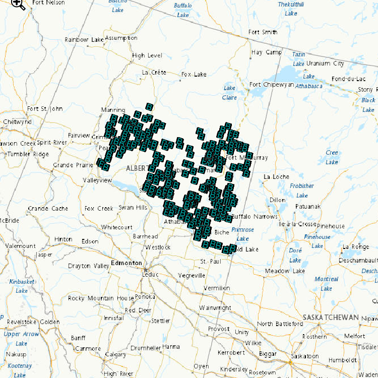
Wild fish health data (length, weight, gonad size, etc.) are now available for trout perch collected from the Athabasca and Peace Rivers; white sucker collected from the Athabasca River; longnose sucker collected from the Peace River; slimy sculpin collected from the Steepbank River; lake chub from Alice Creek, the Ells and Dover Rivers; and longnose dace from the Mackay River. Contaminants data available for walleye collected from the Athabasca and Peace Rivers. For each of these data sets, upstream reference areas are provided for comparison to downstream developed sites. Reference data are currently being evaluated for variability between years to develop triggers, and these triggers are essential to eventually quantify potential effects at exposed sites. Using existing critical effect sizes developed in the Environmental Effects Monitoring programs for pulp and paper and metal mining effluents, condition endpoints in white sucker were increased within the deposit. Slimy sculpin condition and reproductive endpoints are also exceeding effect sizes downstream of development sites. This data is now being used to predict future fish health endpoints within sites, between sites and relative to reference variability to help assess change in fish health.
-
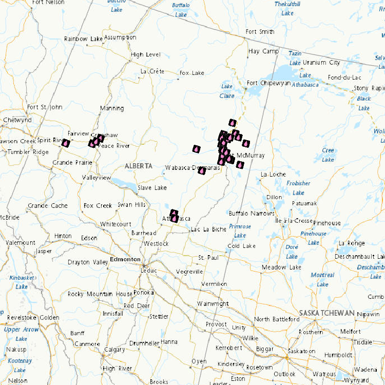
Oil Sands Sediment Exposures of Embryo-larval Fathead Minnows Dataset contains laboratory-studied fathead minnow egg and larval survival rates when exposed to sediments collected from 18 sites in the Athabasca watershed (2010-2014). A controlled laboratory study examined the impacts on fathead minnow eggs and larval development when exposed to collected sediments at concentrations of 1, 5 and/or 25 g/L. Sediments and water were renewed daily, and eggs were assessed as they hatched (in about 5 days), and as the larval fish grew to 8-9 days post hatch (dph), and 15-16 dph. The data in the file present the mean survival (and standard deviation). Two sediment sites caused decreased survival of fathead minnow fry: The Ells River lower site, and the Steepbank River Lower site. These data show that sediment from these sites can affect larval fish survival in the lab. The next steps are to compare these findings to the health data from wild fish collected from these same tributary sites. Toxicity Testing of Groundwater near the Oil Sands Development Dataset contains toxicity studies of groundwaters collected near the Athabasca and Ells rivers. Groundwaters were collected in the summer of 2013 from 4 sites below the riverbeds at depths of 0.5 to 1 metre. Sites were chosen to represent groundwaters close to oil sands tailings ponds and further from tailings ponds and mining activities. Under controlled laboratory conditions, fathead minnow eggs were exposed for 5 days (until hatch) to the groundwaters at standard dilution concentrations of 6, 12, 25, 50, and 100% of the groundwater sample to compare egg and larval fish survival. The data presents the average survival until hatch of 3 repeated exposures (and standard deviation) and 9 repeated exposures for controls. Some groundwater is toxic to minnows and some is not. No correlations were found between toxicity and proximity to a tailings pond. Assessing Toxicity of Oil Sands Related Substances Laboratory fish were exposed to melted snow from sites located close to oil sands mining and upgrading facilities and from sites far away from mining activities to assess the toxicity of substances found in the snow. In addition, river waters, bed sediments, suspended sediments, groundwater and atmospheric depositional samples (pre-melt snow collections) were also tested for toxicity. Fish exposed to undiluted snowmelt showed biological effects. Fish exposed to river water from the region collected during snowmelt conditions showed no effects.
-
This collection of data summarizes the companies reporting under the Renewable Fuels Regulations. This data set includes total liquid petroleum fuel volumes, renewable fuel volumes, and compliance unit creation. This data set also includes information on compliance by company. The information was provided to Environment and Climate Change Canada under the Canadian Environmental Protection Act, 1999.
-
Environment and Climate Change Canada’s cause-effect monitoring is focused on understanding how boreal songbirds, including several Species at Risk, are affected by human activity in the oil sands area, particularly the impact of the physical disturbance of forested habitats from exploration, development and construction of oil sands. Determining the abundance of songbird species associated with various habitat type(s) and understanding how the type and number of birds varies with type and amount of habitat, are important components of assessing the effect of habitat disturbance. Regional-scale monitoring focuses on understanding how and why boreal songbirds, including several Species at Risk, are affected by human activity across the Peace, Athabasca and Cold Lake oil sands area. Local-scale projects focus on addressing gaps in our understanding of complex response patterns at regional scales by targeting specific habitats or development features of interest. These data contribute to: a. improving the design of monitoring programs; b. explaining observed trends in populations (why bird populations are increasing or decreasing); c. predicting population sizes within the oil sands area; and d. assessing the individual, additive and cumulative effects of oil sands and other resource development on boreal birds. Data are used by ECCC and our partners to develop new models and increase the robustness of existing models of bird responses to habitat and disturbance. Because models can be used to predict outcomes of future land management scenarios, these models can assist decision-making by helping evaluate land-use choices before impacts are directly observed.
-
Fish Status and Ecosystem Health - Caged Invertebrates In situ exposures of Hyalella azteca in Athabasca River tributaries - Summary of activities (2010, 2012, 2013, 2014) In situ exposures with Hyalella azteca were conducted within the oil sands region to assess differences in survival and growth of invertebrates caged at natural sites (i.e., exposed to naturally occurring sources of bitumen) compared to sites influenced by oil sands mining activity (i.e., exposed to both naturally occurring and anthropogenic sources of bitumen).Hyalella were collected from a wetland within the Athabasca River watershed but outside the area of oil sands development and activity. They were then placed in cages submerged at 3 sites on the Ells River, 3 sites on the Firebag River, and 4 sites on the Steepbank River. Five cages were deployed per site, each cage containing 20 Hyalella. Cages were removed two weeks after deployment, and Hyalella were counted and weighed as a group to determine growth. The data show no differences in survival or growth of Hyalella caged in situ at any of the 10 sites, when comparing natural sites to sites influenced by oil sands mining activity within each river (i.e., upstream to downstream sites) or between rivers. Caged Mussels Mature mussels (Pyganodon grandis) were collected from a site outside the oil development area (Clearwater River and Long Lake, Alberta) and placed into cages at various sites in the Athabasca River and tributaries for 4 to 6 weeks during the months of August, September and October 2012, 2013 and 2014. The data revealed that mussel growth and survival rates were not affected. Mussels exposed to river water for 4 to 6 weeks were less likely to survive when kept outside of the water for long periods of time (days). Further investigations are warranted to confirm these observations.
-
With the changing climate conditions, marine traffic along Canada’s coastal regions has increased over the past couple of decades and the need to improve our state of preparedness for oil-spill-related emergencies is critical. Baseline coastal information, such as shoreline form, substrate, and vegetation type, is required for prioritizing operations, coordinating onsite spill response activities (i.e. Shoreline Cleanup Assessment Technique [SCAT]), and providing information for wildlife and ecosystem management. Between 2010 and 2017, georeferenced high-definition videography and photos were collected for various study sites across coastal Canada. The study areas include Beaufort Sea, Mackenzie Delta channels and Banks Island in the western Canadian Arctic; James Bay, Hudson Bay, Nunavik, Resolute Bay, Victoria Strait, Baffin Island and Coronation Gulf in the eastern Canadian Arctic; Labrador, Bay of Fundy and Chedabucto Bay in Atlantic Canada and Kitimat, Haida Gwaii and Burrard Inlet in the northern Pacific. Data was collected during ice-free and low tide conditions (where applicable) between July and September. Low-altitude helicopter surveys were conducted at each study site to capture video of the shoreline characteristics. In addition to acquiring videography, ground-based observations were recorded in several locations for validation. Shoreline segmentation was then carried out by manual interpretation of the oblique videography and the photos aided by ancillary data. This involved splitting and classifying the shoreline vectors based on homogeneity of the upper intertidal zone. Detailed geomorphological information (i.e. shoreline type, substrate, slope, height, accessibility etc.) describing the upper intertidal, lower intertidal, supratidal and backshore zones was extracted from the video and entered into a geospatial database using a customized data collection form. In addition, biological characteristics like biobands, water features, fauna, human use etc. observed along the coast were recorded. The data was also validated through ground samples (when available) and a second interpreter QA (quality analysis) was performed on each dataset (excluding Nunavik) to ensure high quality and consistency. The final dataset contains segments ranging in length from 150 metres to 2500 metres. In total, from 2010 to 2017, within the 14 study sites, about 26,150 km of shoreline were mapped.
-
The objectives of the fish component of the integrated oil sands monitoring program are to provide the necessary data/information to address key questions related to both environmental health of fish populations and fish health issues that can be used to inform human use and consumption. The questions underlying the fish monitoring design are related to the status and health of wild fish populations in the Lower Athabasca River including and in an expanded geographical extent. Data is being collected to provide a baseline against which future changes in fish populations will be evaluated, and compared to data from historical studies to assess change over time to the current state. Data is also being collected in areas of new oil sands development, to develop baseline data for future site-specific comparisons, contribute to an expanded geographic basis of the overall monitoring plan, and contribute to an improved ability to examine cumulative effects.
-
Acid-Sensitive Lakes Nine hundred and thirty-three lakes located in Saskatchewan, Alberta and the Northwest Territories were sampled to establish current acidification status. Of the 933 lakes, 244 (or 26%) are considered acid sensitive, almost always because of naturally low calcium and magnesium (or "base cation") concentrations. The most acid-sensitive lakes (i.e., those with extremely low base cation concentrations) are located on the Canadian Shield in both Alberta and Saskatchewan and east of the oils sands development area. Fifty-one of the 244 acid-sensitive lakes were sampled twice annually (spring and fall) to identify chemical changes through trend analyses. Results revealed that 55% of these lakes had concentrations of some metals in excess of Canadian Council of Ministers of the Environment guidelines. Of the 291 samples taken in the 51 lakes, iron concentrations were greater than guidelines in 36% (105 samples), aluminum in 33% (97 samples), lead in 0.3% (1 sample) and copper in 0.3% (1 sample). The metals in these lakes occur naturally and are expected to be found in a wide range of concentrations given the geology and physiography of the Canadian Shield. It remains to establish the relationship between acid sensitivity, geology and high metal concentrations.
-
Atmospheric Contaminant Deposition using Snowpack The data set includes snow samples (metals, water chemistry and polycyclic aromatic hydrocarbons [PAHs]). Data from 2012-2014 snowpack samples collected from ~90-130 sites located varying distances from the major oil sands development area show deposition patterns and levels consistent with earlier studies carried out in 2008 (Kelly et al. PNAS, 2009 and 2010). As with earlier findings, concentrations of numerous metals, water chemistry parameters (Ni, Pb, Zn, V, La, Al, Fe, total Hg, methyl Hg, total suspended solids [TSS], particulate organic carbon [POC], particulate organic nitrogen [PON], total phosphorus [TP]) and PAHs decrease with distance from the major mining extraction and upgrading facilities. Canadian Council of Ministers of the Environment (CCME) guidelines do not exist for snow.
-
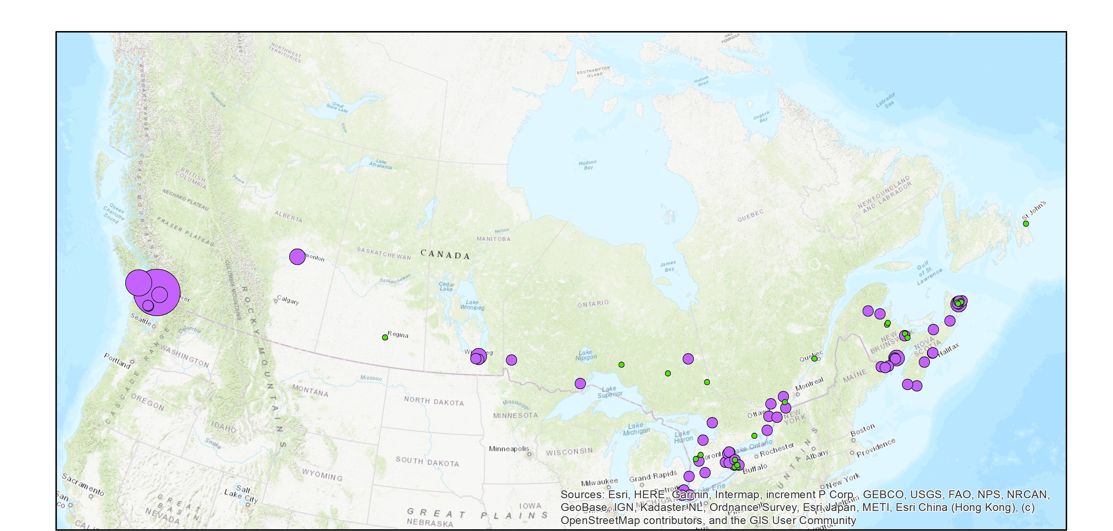
The Wastewater Systems Effluent Regulations (WSER), developed under the Fisheries Act, came into force in 2012 to manage wastewater releases by systems that collect an average daily influent volume of 100 cubic metres or more. The WSER also does not apply to any wastewater system located in the Northwest Territories, Nunavut and north of the 54th parallel in the provinces of Quebec and Newfoundland and Labrador. The WSER set national baseline effluent quality standards that are achievable through secondary wastewater treatment. The WSER require owners or operators of wastewater systems with combined sewers to submit an annual report on the total volume and the number of days wastewater is discharged per month via combined sewer overflow (CSO) points as a result of precipitation. The map below shows the volume of effluent (in cubic metres) discharged in a year from all CSO points situated within the collection area of a wastewater system. For the most part, the volumes provided to ECCC are estimates. Please note, a value of “999999999” in the dataset indicates that the volume data is unavailable and it does not mean that a volume of 999,999,999 m3 was released within the collection area of a wastewater system. The map is available in both ESRI REST (to use with ARC GIS) and WMS (open source) formats. For more information about the individual reporting wastewater systems, datasets are available in either CSV or XLS formats. Data from Quebec As of 2018, no combined sewer overflow volumes from Quebec municipalities are available since an equivalency agreement is now in effect. More information on the wastewater sector including the regulations, agreements, contacts and resource documents is available at: https://www.canada.ca/wastewater