
Water
Type of resources
Topics
Keywords
Contact for the resource
Provided by
Years
Formats
Representation types
Update frequencies
status
-
This database contains detailed information on various sorbents (materials used to absorb chemicals) with a particular emphasis on the compunds abilities to absorb oil from tanker spills.
-
Long-term freshwater quality monitoring data for Rainy River / Lake of the Woods Watershed for the past 15 years or longer for nutrients, metals, major ions, and other physical-chemical variables are included in this dataset. Monitoring is conducted by Environment and Climate Change Canada (ECCC) to assess water quality status and long-term trends, detect emerging issues, establish water quality guidelines and track the effectiveness of remedial measures and regulatory decisions. The information informs and supports the Fresh Water Action Plan.
-
The Emergencies Science Division of ESTC provides Spills Technology Databases including Brochures, Oil Properties, Chemical Synonyms, PPA Instruments and Tanker Spills. This database contains information on the properties of various types of oils, a chemical thesaurus where one can look up synonymous chemical names, and information on over 700 tanker spills
-
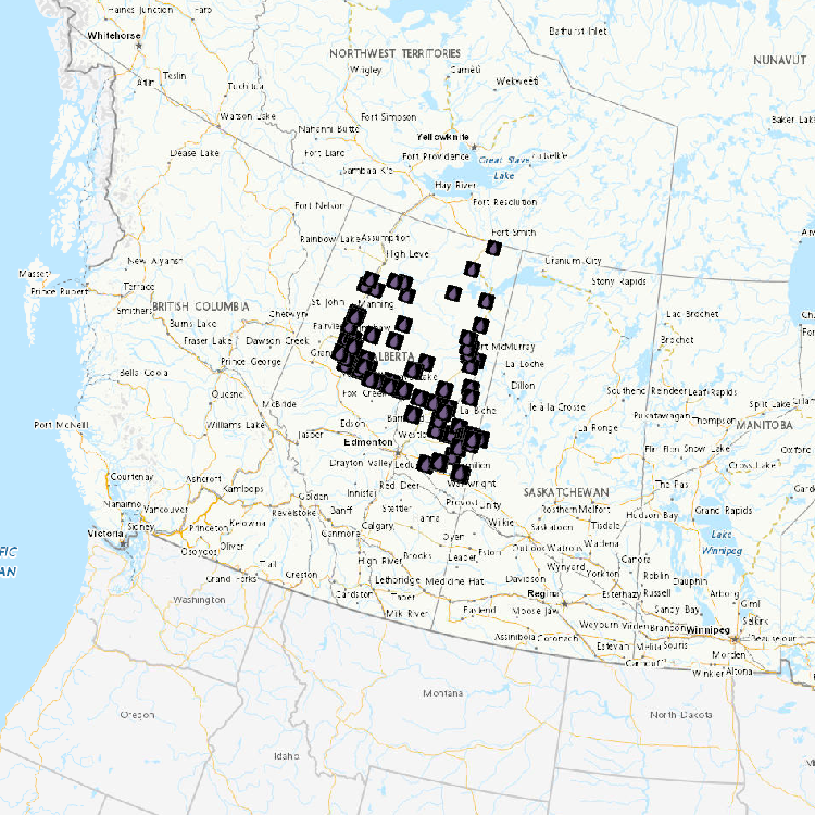
Observations on various types of wetlands, terrestrial environments, and vascular plants for 102 sites visited in 2012 and located on Lake Saint-Pierre are included in this dataset. Since the 1970s, Environment and Climate change Canada (ECCC) has been monitoring changes in wetlands under the State of the St. Lawrence River Monitoring program of the St. Lawrence Action Plan.
-
Observations on various types of wetlands, terrestrial environments, and vascular plants for 55 sites visited in 2012 and located in in the Boucherville Islands are included in this dataset. Since the 1970s, Environment and Climate Change Canada (ECCC) has been monitoring changes in wetlands under the State of the St. Lawrence River Monitoring program of the St. Lawrence Action Plan.
-
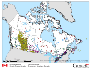
Water level and discharge data are available from Water Survey of Canada’s Hydrometric Network. The Water Survey of Canada (WSC) is the national authority responsible for the collection, interpretation and dissemination of standardized water resource data and information in Canada. In partnership with the provinces, territories and other agencies, WSC operates over 2500 active hydrometric gauges across the country, maintains an archive of historical information for over 7600 stations and provides access to near real-time (water level and stream flow) provisional data at over 1700 locations in Canada.
-
The National Pollutant Release Inventory (NPRI) is Canada's public inventory of pollutant releases (to air, water and land), disposals and transfers for recycling. This file is a geodatabase (GDB) that shows the locations of all facilities that reported to the NPRI in the current reporting year. The data are also available in a virtual globe format : https://open.canada.ca/data/en/dataset/d9be6bec-47e5-4835-8d01-d2875a8d67ff Please consult the following resources to enhance your analysis: - Guide on using and Interpreting NPRI Data: https://www.canada.ca/en/environment-climate-change/services/national-pollutant-release-inventory/using-interpreting-data.html - Access additional data from the NPRI, including datasets and mapping products: https://www.canada.ca/en/environment-climate-change/services/national-pollutant-release-inventory/tools-resources-data/exploredata.html
-

1. Provides public access to real-time instantatenous water level collected at over 1800 active locations in Canada. These data are collected under a national program jointly administered under federal-provincial and federal-territorial cost-sharing agreements; 2. Provides public access to archived daily water level for stations of interest using search criteria. These data include: daily and monthly mean, max and min of water levels. For some sites, annual peaks and extremes are also recorded. Archived water level data are disseminated online; 3. Provides public access to a MS Access database file containing archived daily water level that users can download to their desktop. These data include: daily and monthly mean, max and min of water level. For some sites, annual peaks and extremes are also recorded. MS Access file is updated quarterly; 4. Provides public access to water level statistics for stations of interest using search criteria.
-
The daily water temperature (°C) dataset is reconstructed using the air2stream model (Toffolon and Piccolroaz 2015) with i) air temperature from ~10 km resolution 1980-2018 Regional Deterministic Reforecast System, version 2.1 (Gasset et al. 2021) and ii) streamflow data from the Water Survey of Canada (WSC) hydrometric stations used as the primary inputs. The reconstructed dataset was calibrated/validated with observed water temperature records from various sources. A detailed description of the methodology, sources of observed water temperature, air temperature, and streamflow datasets used in the model setup are available in Shrestha and Pesklevits (2023a and 2023b). Gasset, N., and Coauthors, 2021: A 10 km North American precipitation and land-surface reanalysis based on the GEM atmospheric model. Hydrology and Earth System Sciences, 25, 4917–4945, https://doi.org/10.5194/hess-25-4917-2021. Shrestha, R. R., and J. C. Pesklevits, 2023a: Modelling spatial and temporal variability of water temperature across six rivers in Western Canada. River Research and Applications, 1–14, https://doi.org/10.1002/rra.4072. Shrestha, R.R., J. Pesklevits. 2023b. Reconstructed river water temperature data for western Canada 1980-2018, Data 8, 48 doi.org/10.3390/data8030048. Toffolon, M., and S. Piccolroaz, 2015: A hybrid model for river water temperature as a function of air temperature and discharge. Environ. Res. Lett., 10, 114011, https://doi.org/10.1088/1748-9326/10/11/114011.
-
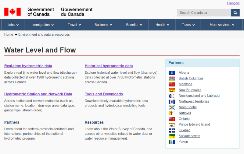
1. Provides public access to real-time instantatenous streamflow collected at over 1800 active locations in Canada. These data are collected under a national program jointly administered under federal-provincial and federal-territorial cost-sharing agreements; 2. Provides public access to archived daily streamflow for stations of interest using search criteria. These data include: daily and monthly mean, max and min of flow. For some sites, annual peaks and extremes are also recorded. Archived streamflow data are disseminated online; 3. Provides public access to a MS Access database file containing archived daily streamflow that users can download to their desktop. These data include: daily and monthly mean, max and min of flow. For some sites, annual peaks and extremes are also recorded. MS Access file is updated quarterly; 4. Provides public access to streamflow statistics for stations of interest using search criteria.