
Oceans
Type of resources
Topics
Keywords
Contact for the resource
Provided by
Years
Formats
Representation types
Update frequencies
status
-
The rationale for developing this product was the recognized need for a standard and adaptable marine grid that could be used for planning or analysis purposes across projects. This nested grid has five spatial resolutions: 8km, 4km, 2km, 1km, and 500m. It covers the extent of the EEZ on the Canadian Pacific coast, and further east in order to encompass the Fraser River Delta and Puget Sound to account for ecological importance. There is a step-by-step methods document that gives users information on how to recreate the grid with ArcMap.
-
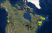
Canada has the longest coastline in the world, measuring 243,790 kilometers. Many of our waterways along the coastline have to be dredged regularly to keep shipping channels and harbours open and safe for navigation; and this material is sometimes best disposed of at sea. Schedule 5 of the Canadian Environmental Protection Act, 1999 (CEPA) defines an exclusive list of materials and substances suitable for disposal at sea in Canada, which is in accordance with the London Protocol (1996). They are: dredged material, fish waste resulting from industrial fish processing operations, ships or platforms, inert and inorganic geological matter, uncontaminated organic matter of natural origin, and bulky substances. The disposal of any substance into the sea, on the seabed, in the subsoil of the seabed, or onto ice, from a ship, an aircraft, a platform or other structure is not allowed unless a permit is issued by the Environment and Climate Change Canada (ECCC) Disposal at Sea Program. Incineration at sea, as well as importing or exporting a substance for disposal at sea is also prohibited. More information on Disposal at Sea is available at: https://www.canada.ca/en/environment-climate-change/services/disposal-at-sea.html The Active and Inactive Disposal at Sea Sites in Canadian Waters dataset provides spatial and related information of at-sea disposal sites approved for use in Canada in the last ten years and that remain open for consideration for additional use. Any additional use of a disposal site must be conducted in accordance with the terms and conditions of a valid Disposal at Sea permit. The dataset may be of use in relation to Disposal at Sea permit applications. For some Disposal at Sea permit applications the data may be of use in assessing serious harm to fish under the Fisheries Act and assessing interference with navigation under the Navigation Protection Act.
-
The Point Lepreau Bird Observatory (PLBO), located in Point Lepreau, New Brunswick, was created as a project of the Saint John Naturalists’ Club (SJNC) in late 1995. The SJNC began accumulating data on bird migration through the Bay of Fundy in spring and fall in 1996. Migration data are collected daily using a sampling method with protocols adapted from Hussell and Ralph (1998). Migration counts using the Hussell and Ralph (1998) count protocol involve a four-hour Count Period consisting of a series of 15-minute counts, each followed by a rest period of equal length. Each Count Period consists of eight 15-minute counts, for a total of two hours, and eight 15-minute periods of rest. Observations are conducted from a permanent observatory building from mid-March to mid-May and from mid-September to mid-November. Observers count all birds seen and since Point Lepreau projects southward into the Bay, birds in spring migration are travelling east when passing it while birds in fall are travelling west. Since the year 2000, counts in spring have been under the supervision of a contracted Official Observer, normally assisted by up to three volunteers. The data are split in to a conditions file and an observations file. The conditions data includes information on weather conditions, sea states and times and durations of each count. The observations data includes observations of birds by species, including numbers of individuals observed and direction of flight. Birds travelling in different directions are recorded separately as are birds resting or feeding on the water.
-
Communities in east Hudson Bay and James Bay are concerned about ecosystem changes observed in recent decades, particularly related to sea-ice conditions, and also about potential impacts of contaminants from long-range atmospheric transport and regional human activities. The Arctic Eider Society’s Community-Driven Research Network (CDRN) was established to measure and better understand large-scale cumulative environmental impacts in east Hudson Bay and James Bay. Building on CDRN collaborations and activities in five communities (Sanikiluaq, Kuujjuaraapik, Inukjuak, Umiujaq, Chisasibi), this Northern Contaminants Program (NCP) community-based project generated new information on metal bioaccumulation that provide a regionally integrated perspective on metal exposure in the marine environment of east Hudson Bay and James Bay.
-
The Stanley Park Winter Waterbird Survey, 1995-2019, was made possible through a co-operative effort between Environment and Climate Change Canada, the British Columbia Institute of Technology’s Wildlife and Recreation Program, and the Stanley Park Ecology Society. The intent of the survey is to collect data to estimate the presence, abundance, and distribution of waterbirds along the Stanley Park foreshore in Vancouver, British Columbia, Canada. This dataset is a compilation of species-level occurrence, abundance and distribution data of marine birds collected systematically for the last 23 years (1995-2019) on roughly a weekly basis between September and April each year along the Stanley Park seawall. This long-term dataset of marine birds, has a high value for analysing spatiotemporal trends in marine bird species.
-

This dataset provides marine bacteriological water quality data for bivalve shellfish harvest areas in Quebec, Canada. Shellfish harvest area water temperature and salinity data are also provided as adjuncts to the interpretation of fecal coliform density data. The latter is the indicator of fecal matter contamination monitored annually by Environment and Climate Change Canada (ECCC) within the framework of the Canadian Shellfish Sanitation Program (CSSP). The geospatial positions of the sampling sites are also provided. These data are collected by ECCC for the purpose of making recommendations on the classification of shellfish harvest area waters. ECCC recommendations are reviewed and adopted by Regional Interdepartmental Shellfish Committees prior to regulatory implementation by Fisheries and Oceans Canada (DFO).
-

This dataset provides marine bacteriological water quality data for bivalve shellfish harvest areas in Prince Edward Island, Canada. Shellfish harvest area water temperature and salinity data are also provided as adjuncts to the interpretation of fecal coliform density data. The latter is the indicator of fecal matter contamination monitored annually by Environment and Climate Change Canada (ECCC) within the framework of the Canadian Shellfish Sanitation Program (CSSP). The geospatial positions of the sampling sites are also provided. These data are collected by ECCC for the purpose of making recommendations on the classification of shellfish harvest area waters. ECCC recommendations are reviewed and adopted by Regional Interdepartmental Shellfish Committees prior to regulatory implementation by Fisheries and Oceans Canada (DFO).
-

This dataset provides geospatial polygon boundaries for marine bivalve shellfish harvest area classification in New Brunswick, Canada. These data represent the five classification categories of marine bivalve shellfish harvest areas (Approved; Conditionally Approved; Restricted; Conditionally Restricted; and Prohibited) under the Canadian Shellfish Sanitation Program (CSSP). Data are collected by Environment and Climate Change Canada (ECCC) for the purpose of making applicable classification recommendations on the basis of sanitary and water quality survey results. ECCC recommendations are reviewed and adopted by Regional Interdepartmental Shellfish Committees prior to regulatory implementation by Fisheries and Oceans Canada (DFO). These geographic data are for illustrative purposes only; they show shellfish harvest area classifications when in Open Status. The classification may be superseded at any time by regulatory orders issued by DFO, which place areas in Closed Status, due to conditions such as sewage overflows or elevated biotoxin levels. For further information about the current status and boundary coordinates for areas under Prohibition Order, please contact your local DFO office.
-

This dataset provides geospatial polygon boundaries for marine bivalve shellfish harvest area classification in Quebec, Canada. These data represent the five classification categories of marine bivalve shellfish harvest areas (Approved; Conditionally Approved; Restricted; Conditionally Restricted; and Prohibited) under the Canadian Shellfish Sanitation Program (CSSP). Data are collected by Environment and Climate Change Canada (ECCC) for the purpose of making applicable classification recommendations on the basis of sanitary and water quality survey results. ECCC recommendations are reviewed and adopted by Regional Interdepartmental Shellfish Committees prior to regulatory implementation by Fisheries and Oceans Canada (DFO). These geographic data are for illustrative purposes only; they show shellfish harvest area classifications when in Open Status. The classification may be superseded at any time by regulatory orders issued by DFO, which place areas in Closed Status, due to conditions such as sewage overflows or elevated biotoxin levels. For further information about the current status and boundary coordinates for areas under Prohibition Order, please contact your local DFO office.
-

This dataset provides geospatial polygon boundaries for marine bivalve shellfish harvest area classification in Nova Scotia, Canada. These data represent the five classification categories of marine bivalve shellfish harvest areas (Approved; Conditionally Approved; Restricted; Conditionally Restricted; and Prohibited) under the Canadian Shellfish Sanitation Program (CSSP). Data are collected by Environment and Climate Change Canada (ECCC) for the purpose of making applicable classification recommendations on the basis of sanitary and water quality survey results. ECCC recommendations are reviewed and adopted by Regional Interdepartmental Shellfish Committees prior to regulatory implementation by Fisheries and Oceans Canada (DFO). These geographic data are for illustrative purposes only; they show shellfish harvest area classifications when in Open Status. The classification may be superseded at any time by regulatory orders issued by DFO, which place areas in Closed Status, due to conditions such as sewage overflows or elevated biotoxin levels. For further information about the current status and boundary coordinates for areas under Prohibition Order, please contact your local DFO office.