
Climate
Type of resources
Topics
Keywords
Contact for the resource
Provided by
Years
Formats
Representation types
Update frequencies
status
-
Precipitation measurements in the Environment and Climate Change Canada (ECCC) surface network are a necessary component for monitoring weather and climate and are required for flood and water resource forecasting, numerical weather prediction and many other applications that impact the health and safety of Canadians. Beginning in the late 1990s, the ECCC surface network began a transition from manual to automated precipitation measurements. Advantages to increased automation include enhanced capabilities for monitoring in remote locations and higher observation frequency at lower cost. However, transition to automated precipitation gauges has resulted in new challenges to data quality, accuracy, and homogenization. Automated weighing precipitation gauges used in the ECCC operational network, because of their physical profile, tend to measure less precipitation falling as snow because lighter particles (snow) are deflected away from the collector by the wind flow around the gauge orifice. This phenomenon of wind-induced systematic bias is well documented in the literature. The observation requires an adjustment depending on gauge and shield configuration, precipitation phase, temperature, and wind speed. Hourly precipitation, wind speed, and temperature for 397 ECCC automated surface weather stations were retrieved from the ECCC national archive. Climate Research Division (CRD) selected this sub-set of stations because they are critical to the continuity of various climate analysis. The observation period varies by station with the earliest data series beginning in 2001 (with most beginning in 2004). The precipitation data was quality controlled using established techniques to identify and flag outliers, remove spurious observations, and correct for previously identified filtering errors. The resulting hourly precipitation data was adjusted for wind bias using the WMO Solid Precipitation Inter-Comparison Experiment (SPICE) Universal Transfer Function (UTF) equation. A full description of this data set, including the station locations, data format, methodology, and references are included in the repository.
-
The Homogenized Surface Pressure data consist of monthly, seasonal and annual means of hourly sea level and station pressure (hectopascals) for 626 locations in Canada. Homogenized climate data incorporate adjustments (derived from statistical procedures) to the original station data to account for discontinuities from non-climatic factors, such as instrument changes or station relocation. The time periods of the data vary by location, with the oldest data available from 1953 at some stations to the most recent update in 2014. Data availability over most of the Canadian Arctic is restricted to 1953 to present. The data will continue to be updated every few years (as time permits).
-
This dataset contains blended (gauge and satellite estimates) pentad mean precipitation rates (unit: mm/day) at a one degree spatial resolution over Canada. The data can be used for hydrometeorological, agricultural, forestry modelling, for numerical weather model and climate model verification, and for climate impact studies.
-
The data consists of temperature indices based on homogenized daily maximum and minimum temperatures at 338 locations across Canada, and of precipitation indices based on adjusted daily rainfall, daily snowfall and daily precipitation amounts at 463 locations across the country. These indices were selected for their relevance to social and economic impact assessment in Canada and for the insights they could provide regarding changes in extreme climate conditions. Please refer to the papers below for detailed information regarding the adjustment procedures and the trends in the indices.
-
Humidex (Masterton and Richardson 1979) is an index developed by the Meteorological Service of Canada to describe how hot and humid the weather feels to the average person. In Canada, it is recommended that outdoor activities be moderated when the humidex exceeds 30, and that all unnecessary activities cease when it passes 40 (Mekis et al., 2015). With the increase in temperature projected by climate models over the coming decades over Canada, increases are also expected in the number of days with high-value Humidex across the country, which will have important consequences for human health. This dataset consists of a multi-model ensemble of statistically downscaled climate model projections for three humidex threshold indices (annual number of days when humidex exceeds 30, 35 and 40, noted HXmax30, HXmax35 and HXmax40 respectively) on a 0.1-degree latitude-longitude grid over Canada. The three indices (HXmax30, HXmax35 and HXmax40) are available for download at annual time step and 30-year averages from 1950 to 2100, for each of the 19 individual models and for the 10th, 50th, and 90th ensemble percentiles. The multi-model ensemble is using output from 19 Coupled Model Intercomparison Project Phase 6 (CMIP6) global climate models (GCM) that are available at the Earth System Grid Federation (ESGF) Data Nodes, for three emission scenarios called “Shared Socioeconomic Pathways” (SSPs) (Riahi et al. 2017): SSP126, SSP245 and SSP585. The GCM outputs were statistically downscaled and bias corrected using the N-dimensional probability density function transform multivariate quantile mapping method (Cannon, 2018) against ERA5-Land data (Muñoz, 2019), using a method described in Diaconescu et al. (2022). This method is based on the observation that the time when Humidex reaches its daily maximum coincide statistically with the time when temperature reaches its daily maximum and relative humidity reaches its daily minimum. In order to eliminate model biases and the errors in the adjustment method, the daily maximum temperature and daily minimum relative humidity from GCMs are statistically downscaled and bias corrected against the hourly temperature and relative humidity at the time of daily maximum humidex from ERA5-Land. The bias-corrected values are used to compute the daily maximum humidex and next the three threshold annual indices. These ensembles of indices are intended to enable users to better identify and reduce the susceptibility of vulnerable populations to illness and mortality due to increase in the frequency and intensity of extreme heat events due to climate change. References: Cannon, A. J. (2018). 'Multivariate quantile mapping bias correction: an N-dimensional probability density function transform for climate model simulations of multiple variables', Climate Dynamics, 50(1-2), 31-49. Available at https://doi.org/10.1007/s00382-017-3580-6 Diaconescu, E. P. et al. (2022) ' A short note on the use of daily climate data to calculate Humidex heat-stress indices', International Journal of Climatology, 1– 13. https://doi.org/10.1002/joc.7833 Masterton, J. M., and Richardson, F. (1979) 'Humidex: a method of quantifying human discomfort due to excessive heat and humidity', Environment Canada, Atmospheric Environment, 45. Mekis, É., et al. (2015) 'Observed trends in severe weather conditions based on humidex, wind chill, and heavy rainfall events in Canada for 1953–2012', Atmosphere-Ocean, 53, 383-397. Available at https://doi.org/10.1080/07055900.2015.1086970, (Accessed: 19 April 2022). Muñoz Sabater, J., 2019: ERA5-Land hourly data from 1981 to present. Copernicus Climate Change Service (C3S) Climate Data Store (CDS). (Accessed on < 25-Jun-2021 >), https://doi.org/10.24381/cds.e2161bac Riahi, K., van Vuuren, D. P., Kriegler, E., Edmonds, J., O’Neill, B. C., Fujimori, S., Bauer, N., Calvin, K., Dellink, R., Fricko, O., Lutz, W., Popp, A., Crespo Cuaresma, J., KC, S., Leimbach, M., Jiang, L., Kram, T., Rao, S., Emmerling, J., Ebi, K., Hasegawa, T., Havlik, P., Humpenöder, F., Aleluia Da Silva, L., Smith, S., Stehfest, E., Bosetti, V., Eom, J., Gernaat, D., Masui, T., Rogelj, J., Strefler, J., Drouet, L., Krey, V., Luderer, G., Harmsen, M., Takahashi, K., Baumstark, L., Doelman, J., Kainuma, M., Klimont, Z., Marangoni, G., Lotze-Campen, H., Obersteiner, M., Tabeau, A., & Tavoni, M. (2017). The Shared Socioeconomic Pathways and their energy, land use, and greenhouse gas emissions implications: An Overview. Global Environmental Change, 42, 153-168. https://doi.org/10.1016/j.gloenvcha.2016.05.009
-
The purpose of the Long-Range Forecast Transient Intercomparison Project (LRFTIP) is to provide an archive of hindcast climatologies, describing the systematic behavior of models evolving from observation-based initial states, that can inform investigations into the transient behavior of initialized subseasonal to decadal climate predictions, the development of model biases, and the relative merits of different initialization methods. The archive is based on publicly available hindcast datasets including the Subseasonal to Seasonal Prediction Project (S2S), the Climate-system Historical Forecast Project (CHFP) and the Coupled Model Intercomparison Project Phase 5 (CMIP5) and 6 (CMIP6). ECCC models include the GEPS-based contribution to S2S, the CanCM3, CanCM4, CanCM4i and GEM-NEMO seasonal prediction models, and the CanCM4 CMIP5 and CanESM5 CMIP6 decadal prediction models. Additional contributions are being added as they become available.
-
The suite of gridded precipitation datasets includes the ANUSPLIN-gridded datasets of daily precipitation since 1900 (ANUSPLIN-AdjPdly), pentad average precipitation rates since 1950 (ANUSPLIN-AdjP5d), and monthly total precipitation since 1872 (ANUSPLIN-AdjPmly), on a 0.083333ºx 0.083333º latitude-longitude grid over Canada. For version 1 of these datasets, the daily precipitation data were generated from the ANUSPLIN surfaces fitted to the Adjusted Daily Rainfall and Snowfall (AdjDlyRS) dataset version 2016, which includes 3346 stations of manual observations (Wang et al. 2017; available at https://open.canada.ca/data/en/dataset/d8616c52-a812-44ad-8754-7bcc0d8de305). The monthly and pentad gridded data were generated from the ANUSPLIN surfaces fitted respectively to the monthly and pentad station data that were derived from the corresponding daily station data. When deriving the monthly station data from the daily station data, the monthly total precipitation was set to missing if there was one or more missing daily value in the month (zero tolerance for missing). The same zero tolerance for missing observations was applied in the calculation of the pentad average precipitation rates. Details of the ANUSPLIN modelling of these three gridded precipitation datasets are provided in MacDonald et al. (2020), along with comparison to the unadjusted ANUSPLIN-gridded daily precipitation dataset (Hutchinson et al. 2009). Note that the unadjusted precipitation data significantly underestimate both the precipitation amount and the regional mean long-term trend therein (MacDonald et al. 2020). It is important to point out that these ANUSPLIN-AdjP datasets are not homogenized and thus should not be used to assess climate trends/changes before ensuring the temporal homogeneity of the data. Considering there were no or few stations in the North in the early period, the gridded values in the period before 1930 were set to missing (missing code -999.00) for all gridpoints north of 65ºN and west of 110ºW (including 110ºW) and for all gridpoints north of 55ºN and east of 110ºW. The gridded values in the period of 1930-1949 were also set to missing for all gridpoints north of 70ºN. For the period from 1950 onwards, the grid covers the whole land mass of Canada. References: (1) MacDonald, H., D.W. McKenney, X.L. Wang, J. Pedlar, P. Papadopol, K. Lawrence, and M.F. Hutchinson, 2021: Spatial models of adjusted precipitation for Canada at varying time scales. J. Appl. Meteor. Climatol., 60, 291-304. doi: 10.1175/JAMC-D-20-0041.1. (2) Wang, X.L., H. Xu, B. Qian, Y. Feng, and E. Mekis, 2017: Adjusted daily rainfall and snowfall data for Canada. Atmos.-Ocean, 55, 155–168, doi:10.1080/07055900.2017.1342163. (3) Hutchinson, M.F.,D.W. McKenney, K. Lawrence, J.H. Pedlar, R. F.Hopkinson, E.Milewska, and P. Papadopol, 2009: Development and testing of Canada-wide interpolated spatial models of daily minimum–maximum temperature and precipitation for 1961–2003. J. Appl. Meteorol. Climatol., 48, 725-741. doi:10.1175/2008JAMC1979.1.
-
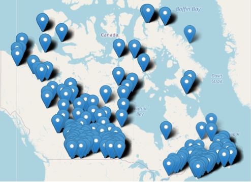
A Virtual Climate station is the result of threading together climate data from proximate current and historical stations to construct a long term threaded data set. For the purpose of identifying and tabulating daily extremes of record for temperature, precipitation and snowfall, the Meteorological Service of Canada has threaded or put together data from closely related stations to compile a long time series of data for about 750 locations in Canada to monitor for record-breaking weather. The length of the time series of virtual stations is often greater than 100 years. A Virtual Climate station is always named for an “Area” rather than a point, e.g. Winnipeg Area, to indicate that the data are drawn from that area (within a 20km radius from the urban center) rather than a single precise location.
-
This database contains model output files that were used in the 2021 Arctic Monitoring and Assessment Programme (AMAP) Assessment Report on Short-lived Climate Forcers (SLCFs) and subsequent journal publications. The datasets are stored here: http://crd-data-donnees-rdc.ec.gc.ca/CCCMA/products/AMAP/ Type0 model files are basic historical simulations. Types 1 and 2 are model sensitivity simulations with regionally perturbed emissions and type 3 are future simulations under varying emission scenarios. Please see the file "AMAPdatabaseREADME.xlxs" at the data location for further explanation.
-
This first version of the dataset (CanHoPmlyV1) contains homogenized time series of monthly total precipitation for 425 long-term stations in Canada. As detailed in Wang et al. (2023), it is based on the quality-controlled version 2020 of the Adjusted Daily Rainfall and Snowfall (AdjDlyRS) dataset (Wang et al. 2017; available at http://open.canada.ca/data/en/dataset/d8616c52-a812-44ad-8754-7bcc0d8de305), and on daily total precipitation data from automated gauges (including Belfort, Fisher & Porter, Nipher, Geonor, and Pluvio), with some records from neighbouring stations being joined to form long-term data series. Version 1 of ANUSPLIN surfaces of the adjusted monthly precipitation (MacDonald et al. 2021, available at https://open.canada.ca/data/en/dataset/779ea77a-0ad1-42f2-853e-833e1cbb9a13) was used to infill temporal data gaps in the 425 data series. A comprehensive semi-automatic data homogenization procedure was used to homogenize the data series. The aforementioned ANUSPLIN data and the Twentieth Century Reanalysis 20CRv3 ensemble-mean series of monthly precipitation (Slivinski et al., 2021) were used as reference in the homogeneity tests (Wang et al., 2023). The homogenized dataset provides more realistic trend estimates and shows better spatial consistency of trends than does the raw dataset (Wang et al. 2023). References: Wang, X.L, Y. Feng, V. Y. S. Cheng, H. Xu, 2023: Observed precipitation trends inferred from Canada’s homogenized monthly precipitation dataset, J. Clim., in press. DOI: 10.1175/JCLI-D-23-0193.1. Wang, X. L., H. Xu, B. Qian, Y. Feng, E. Mekis, 2017: The adjusted daily rainfall and snowfall data for Canada. Atmosphere-Ocean, 55:3, 155-168, DOI:10.1080/07055900.2017.1342163. MacDonald, H., D. W. McKenney, X. L. Wang, J. Pedlar, P. Papadopol, K. Lawrence, M. F. Hutchinson, 2021: Spatial Models of adjusted precipitation for Canada at varying time scales. J. Appl. Meteor. And Climatol., 60, 291-304. DOI: 10.1175/JAMC-D-20-0041.1. Slivinski, L. and coauthors, 2019: Towards a more reliable historical reanalysis: Improvements for version 3 of the Twentieth Century Reanalysis system. Q. J. R. Meteor. Soc., 2876-2908, https://doi.org/10.1002/qj.3598.