
Regional
Type of resources
Topics
Keywords
Provided by
Years
Formats
Representation types
Update frequencies
status
-
The Regional Air Quality Deterministic Prediction System FireWork (RAQDPS-FW) carries out physics and chemistry calculations, including emissions from active wildfires, to arrive at deterministic predictions of chemical species concentration of interest to air quality, such as fine particulate matter PM2.5 (2.5 micrometers in diameter or less). Geographical coverage is Canada and the United States. Data is available at a horizontal resolution of 10 km. While the system encompasses more than 80 vertical levels, data is available only for the surface level. The products are presented as historical, annual or monthly, averages which highlight long-term trends in cumulative effects on the environment.
-
The Regional Ensemble storm Surge Prediction System (RESPS) produces storm surge forecasts using the DalCoast ocean model. DalCoast (Bernier and Thompson 2015) is a storm surge forecast system for the east coast of Canada based on the depth-integrated, barotropic and linearized form of the Princeton Ocean Model. The model is forced by the 10 meters winds and sea level pressure from the Global Ensemble Prediction System (GEPS).
-
The Regional Deterministic Air Quality Analysis (RDAQA) is an objective analysis of surface pollutants which combines numerical forecasts from the Regional Air Quality Deterministic Prediction System (RAQDPS) and hourly observational data from monitoring surface networks over North America in order to produce a better description of the air quality at every hour. Chemical constituents include 03, SO2, and NO2 gases, as well as fine particulate matter PM2.5 (2.5 micrometers in diameter or less) and coarse particulate matter PM10 (10 micrometers in diameter or less). Geographical coverage is Canada and the United States. Data is available only for the surface level, at a horizontal resolution of 10 km. The products are presented as historical, annual or monthly, averages which highlight long-term trends in cumulative effects on the environment.
-
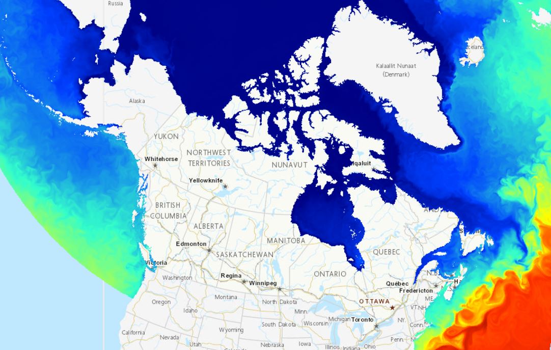
The Regional Ice-Ocean Prediction System (RIOPS) is based on the NEMO-CICE ice-ocean model and produces regional sea ice and ocean analyses and 84 hours forecasts daily based at [00, 06, 12, 18] UTC on a subset of the 1/12° resolution global tri-polar grid (ORCA12). RIOPS assimilates data (gridded CCMEP analysis SST product, SLA from satellite altimetry, in situ observations) using a multivariate reduced order Kalman filter and includes a 3DVar ice concentration analysis (assimilating satellite remote sensing and Canadian Ice Service ice charts). Atmospheric fluxes for 84 hours forecasts are calculated using fields from a blending of the Regional Deterministic Prediction System (RDPS) and the Global Deterministic Prediction System (GDPS).
-
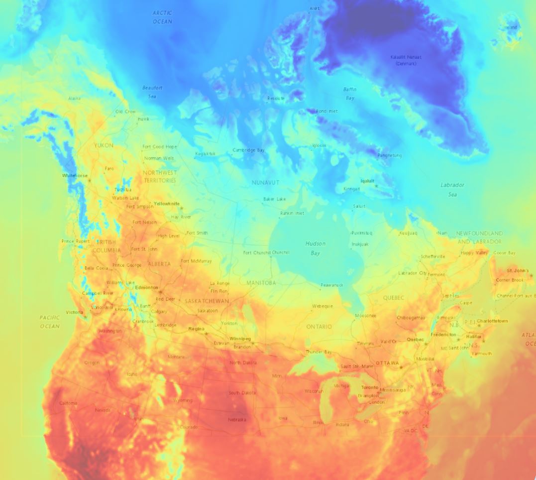
The Regional Deterministic Prediction System (RDPS) carries out physics calculations to arrive at deterministic predictions of atmospheric elements from the current day out to 84 hours into the future. Atmospheric elements include temperature, precipitation, cloud cover, wind speed and direction, humidity and others. This product contains raw numerical results of these calculations. Geographical coverage includes Canada and the United States. Data is available at horizontal resolution of about 10 km up to 33 vertical levels. Predictions are performed four times a day.
-
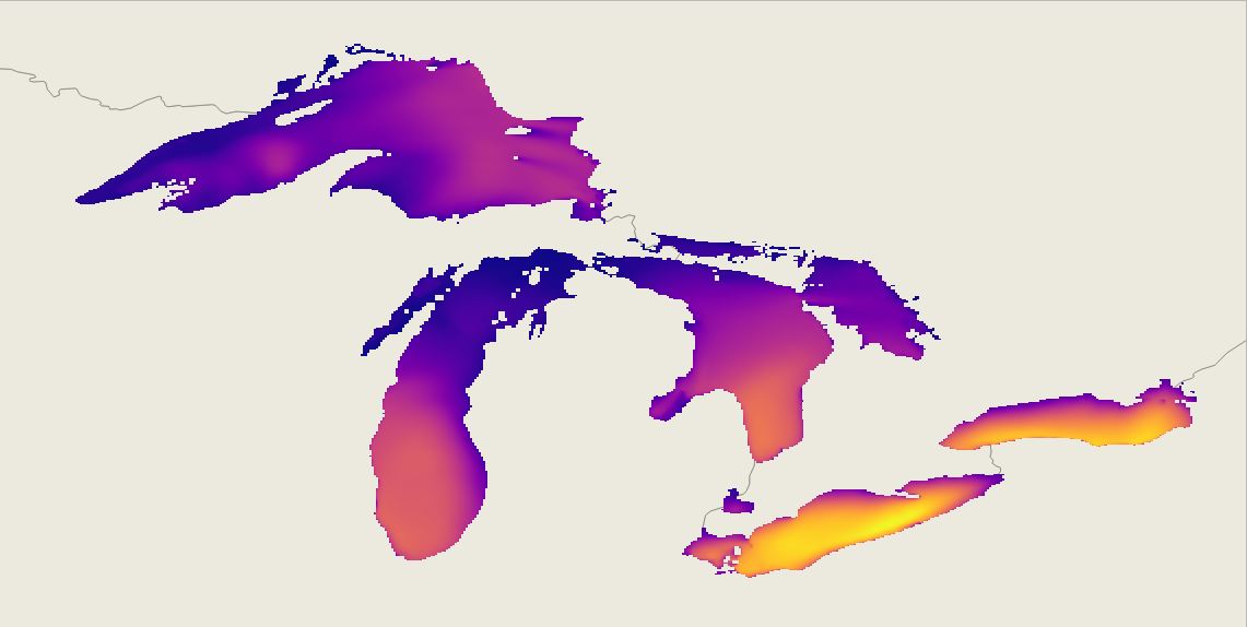
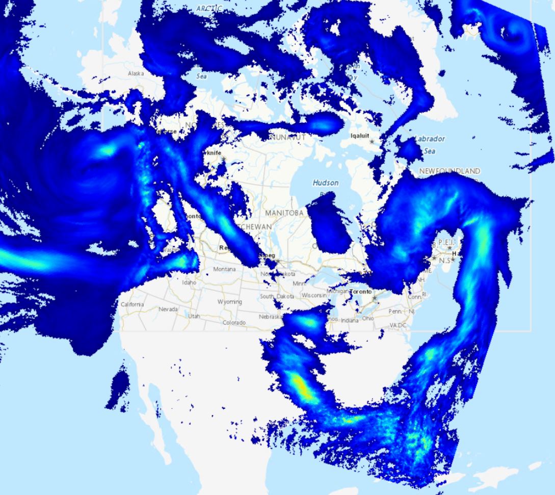
The Regional Ensemble Wave Prediction System (REWPS) uses the third generation spectral wave model WaveWatch III® (WW3) to arrive at probabilistic predictions of wave elements from the current day out to 3 days into the future. The probabilistic predictions are based on 20 ensemble members and a control member that are forced by the 10 meters winds from the Regional Ensemble Prediction System (REPS). An ice forecast from the Water Cycle Prediction System of the Great Lakes (WCPS) is used by the model to dampen or suppress wave growth in areas covered respectively with 25% to 75% and more than 75% ice. WW3 (WAVEWATCH III® Development Group, WW3DG 2019) is a third generation spectral wave prediction model that solves the evolution of the energy balance equation for the 2-D wave energy spectrum without any prior assumptions on the shape of the spectrum. The WW3 model has been implemented by a growing number of national operational forecasting centres over the last several years. The REWPS data are available on the Great Lakes domain.
-
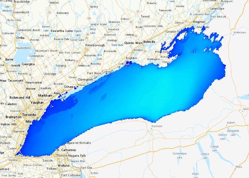
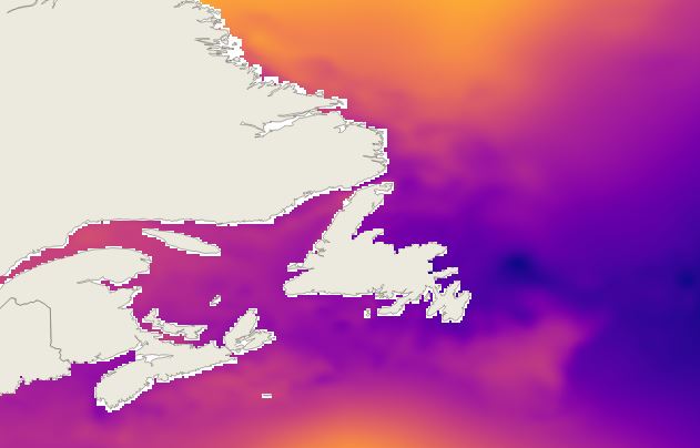
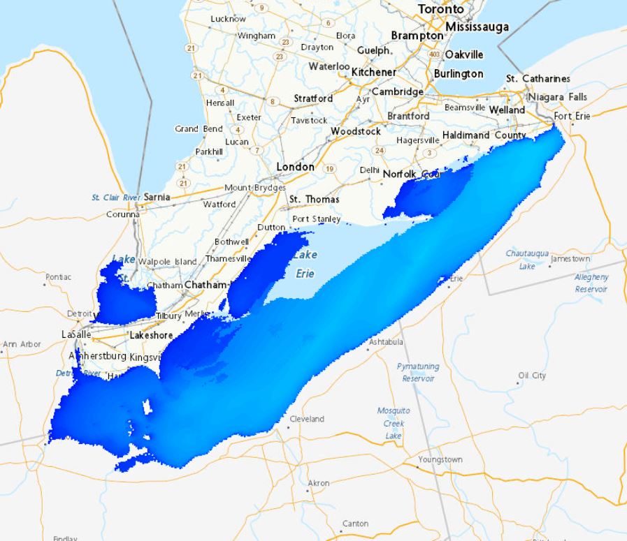
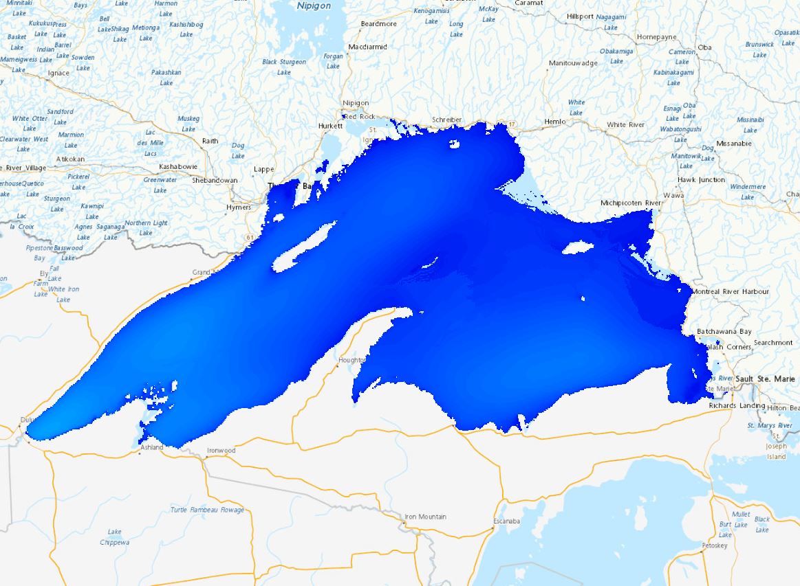
The Regional Deterministic Wave Prediction System (RDWPS) produces wave forecasts out to 48 hours in the future using the third generation spectral wave forecast model WaveWatch III® (WW3). The model is forced by the 10 meters winds from the High Resolution Deterministic Prediction System (HRDPS). Over the Great Lakes, an ice forecast from the Water Cycle Prediction System of the Great Lakes (WCPS) is used by the model to attenuate or suppress wave growth in areas covered by 25% to 75% and more than 75% ice, respectively. Over the ocean, an ice forecast from the Regional Ice Ocean Prediction System (RIOPS) is used: in the Northeast Pacific, waves propagate freely for ice concentrations below 50%, above this threshold there is no propagation; in the Northwest Atlantic the same logic is used as in the Great Lakes. Forecast elements include significant wave height, peak period, partitioned parameters and others. This system includes several domains: Lake Superior, Lake Huron-Michigan, Lake Erie, Lake Ontario, Atlantic North-West and Pacific North-East.
-
The Regional Ensemble Prediction System (REPS) carries out physics calculations to arrive at probabilistic predictions of atmospheric elements from the current day out to 3 days into the future. The probabilistic predictions are based on 20 ensemble members that are perturbed through their initial and boundary conditions as well as physical tendencies. A control member that is not perturbed is also available. Atmospheric elements include temperature, precipitation, cloud cover, wind speed and direction, humidity and others. This product contains raw numerical results of these calculations. Geographical coverage includes Canada and the United States. Data is available at a horizontal resolution of 10 km. Data is available on ten vertical levels. Predictions are performed four times a day.