
Deterministic
Type of resources
Topics
Keywords
Provided by
Years
Formats
Representation types
Update frequencies
status
-
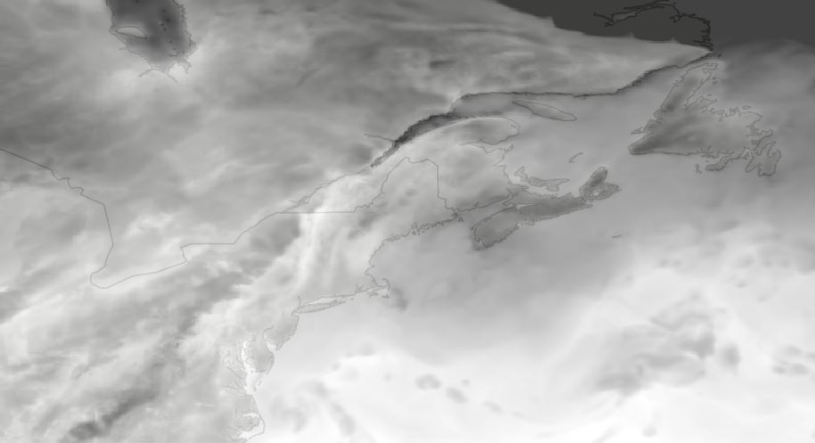
WCPS-coupled forecast is the component in the Water Cycle Prediction System (WCPS) that provides the coupled atmosphere-ocean-sea ice forecasts at a 1km resolution (0.008 x 0.008 degree) over the Great Lakes, St. Lawrence River and the Gulf of St. Lawrence. It launches 4 times a day at 00, 06, 12, and 18 UTC and produces 84 hours forecast, based on the atmospheric model GEM, coupled with the ocean-ice model NEMO-CICE. The products from WCPS-coupled forecasts are (1) GEM : surface air temperatures, surface wind velocities, and surface runoff (2) NEMO-CICE : variety of lake/ocean sea ice variables, for example, lake levels and temperatures. They are designed to help forecasters issuing bulletins and warnings in ice-infestested waters for navigation, water level alert, emergency response, Search and Rescue, and CIS Sea Ice forecast.
-
The Global Deterministic storm Surge Prediction System (GDSPS) produces water level forecasts using a modified version of the NEMO ocean model (Wang et al. 2021, 2022, 2023). It provides 240 hours forecasts twice per day on a 1/12° resolution grid (3-9 km). The model is forced by the 10 meters winds, sea level pressure, ice concentration, ice velocity and surface currents from the Global Deterministic Prediction System (GDPS). The three dimensionnal ocean temperature and salinity fields of the model are nudged to values provided by the Global Ice-Ocean Prediction System (GIOPS) and the GDPS. During the post-processing phase, storm surge elevation (ETAS) is derived from total water level (SSH) by harmonic analysis using t_tide (Foreman et al. 2009).
-
The High Resolution Deterministic Land Prediction System (HRDLPS) produces high-resolution medium-range forecasts of land surface, subsurface variables, and of near-surface atmospheric variables (1.5 m temperature and dewpoint, 10 m wind). HRDLPS is initialized with analysis and trial fields provided by the Canadian Land Data Assimilation System of the National Surface and River Prediction System (CaLDAS-NSRPS). The system is then driven with atmospheric forecasts provided by the HRDPS over the first two days of integration and by the GDPS over the next four days. Predictions are performed twice a day. The system runs on a grid with a 2.5 km horizontal spacing covering Canada and part of the USA.
-
The Regional Deterministic Prediction System (RDPS) carries out physics calculations to arrive at deterministic predictions of atmospheric elements from the current day out to 84 hours into the future. Atmospheric elements include temperature, precipitation, cloud cover, wind speed and direction, humidity and others. This product contains raw numerical results of these calculations. Geographical coverage includes Canada and the United States. Data is available at horizontal resolution of about 10 km up to 33 vertical levels. Predictions are performed four times a day.
-
The Regional Deterministic Wave Prediction System (RDWPS) produces wave forecasts out to 48 hours in the future using the third generation spectral wave forecast model WaveWatch III® (WW3). The model is forced by the 10 meters winds from the High Resolution Deterministic Prediction System (HRDPS). Over the Great Lakes, an ice forecast from the Water Cycle Prediction System of the Great Lakes (WCPS) is used by the model to attenuate or suppress wave growth in areas covered by 25% to 75% and more than 75% ice, respectively. Over the ocean, an ice forecast from the Regional Ice Ocean Prediction System (RIOPS) is used: in the Northeast Pacific, waves propagate freely for ice concentrations below 50%, above this threshold there is no propagation; in the Northwest Atlantic the same logic is used as in the Great Lakes. Forecast elements include significant wave height, peak period, partitioned parameters and others. This system includes several domains: Lake Superior, Lake Huron-Michigan, Lake Erie, Lake Ontario, Atlantic North-West and Pacific North-East.
-
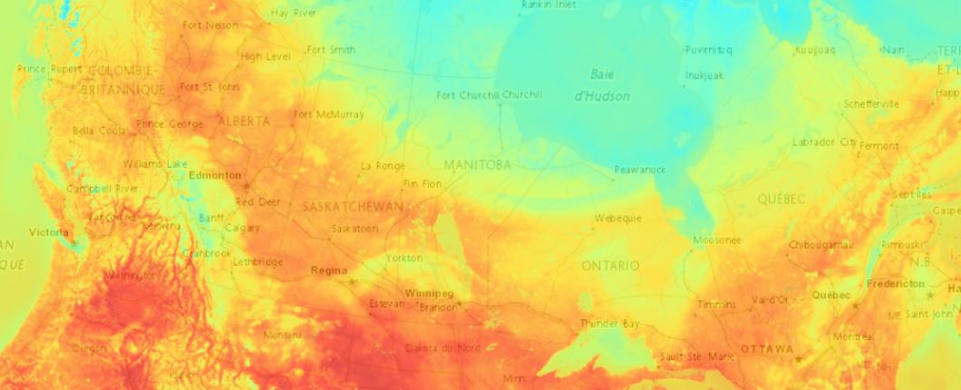
The High Resolution Deterministic Prediction System (HRDPS) carries out physics calculations to arrive at deterministic predictions of atmospheric elements from the current day out to 48 hours into the future. Atmospheric elements include temperature, precipitation, cloud cover, wind speed and direction, humidity and others. This product contains raw numerical results of these calculations. Geographical coverage of the system is most of Canada. Data is available over specific areas in the MSC Datamart and the whole coverage is available in the MSC GeoMet web services. Data is available at a horizontal resolution of about 2.5 km up to 31 vertical levels. Predictions are performed up to four times a day.
-
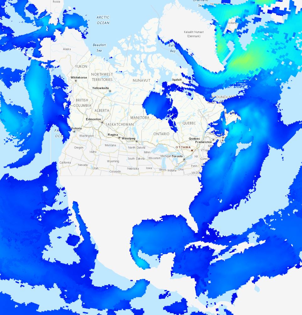
The Global Deterministic Wave Prediction System (GDWPS) produces wave forecasts out to 120 hours in the future using the third generation spectral wave forecast model WaveWatch III® (WW3). The model is forced by the 10 meters winds and the ice concentration from the Global Deterministic Prediction System (GDPS). The ice concentration is used by the model to attenuate wave growth in areas covered by 25% to 75% ice and to suppress it for concentration above 75%. Forecast elements include significant wave height, peak period and primary swell height, direction and period.
-
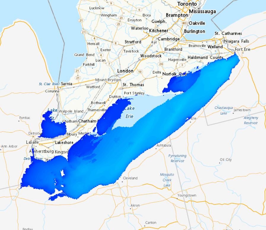
The Regional Deterministic Wave Prediction System (RDWPS) produces wave forecasts out to 48 hours in the future using the third generation spectral wave forecast model WaveWatch III® (WW3). The model is forced by the 10 meters winds from the High Resolution Deterministic Prediction System (HRDPS). Over the Great Lakes, an ice forecast from the Water Cycle Prediction System of the Great Lakes (WCPS) is used by the model to attenuate or suppress wave growth in areas covered by 25% to 75% and more than 75% ice, respectively. Over the ocean, an ice forecast from the Regional Ice Ocean Prediction System (RIOPS) is used: in the Northeast Pacific, waves propagate freely for ice concentrations below 50%, above this threshold there is no propagation; in the Northwest Atlantic the same logic is used as in the Great Lakes. Forecast elements include significant wave height, peak period, partitioned parameters and others. This system includes several domains: Lake Superior, Lake Huron-Michigan, Lake Erie, Lake Ontario, Atlantic North-West and Pacific North-East.
-
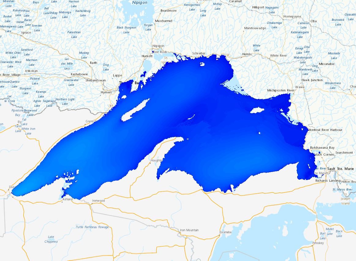
The Global Deterministic Prediction System (GDPS) is a coupled atmosphere (GEM), ocean and sea ice (NEMO-CICE) deterministic numerical weather prediction model. Forecasts are carried out twice a day for 10 days lead time. The geographical coverage is global on a native Yin-Yang grid at 15 km horizontal resolution. Data is available for 33 vertical levels and interpolated on a global latitude-longitude uniform grid with 0.2 degree horizontal resolution. Variables availability in number and time frequency is a function of forecast lead time.