Regional Deterministic Precipitation Analysis
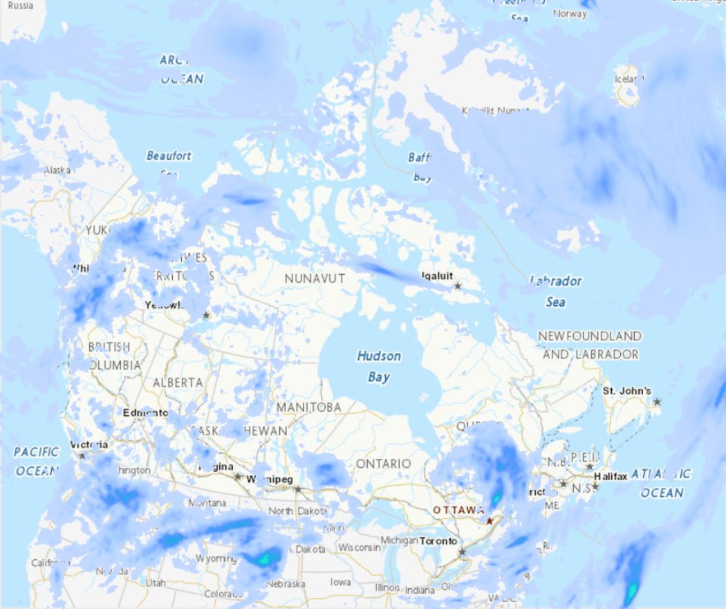
The Regional Deterministic Precipitation Analysis (RDPA) produces a best estimate of the amount of precipitation that occurred over recent past periods of 6 or 24 hours. The estimate integrates data from in situ precipitation gauge measurements, weather radar, satellite imagery and numerical weather prediction models. Geographic coverage is North America (Canada, United States and Mexico). Data is available at horizontal resolution of 10 km. Data is only available for the surface level. Analysis data is made available four times a day for 6h intervals and twice a day for the 24h interval. A preliminary estimate is available approximately 1h after the end of the accumulation period, and revised 7h after in order to assimilate gauge data arriving later.
Basic view
Metadata Record Information
- File Identifier
- fdd3446a-dc20-5bad-9755-0855e3ec9b19 XML
- Date Stamp
- 2024-03-28T15:32:50
- Metadata language
-
eng; CAN
- Character set
- UTF8
- Hierarchy Level
- Dataset
+01-506-451-6010
https://www.canada.ca/en/environment-climate-change.html
- Hours of Service
-
0700h - 1500h EST
Data identification
- Date (Creation)
- 2011-04-06
- Date (Publication)
- 2022-07-06
- Status
- On going
- Metadata language
-
eng; CAN
- Character set
- UTF8
- Topic category
-
- Climatology, meteorology, atmosphere
- Maintenance and Update Frequency
- Continual
- Spatial representation type
- Grid
+01-506-451-6010
https://www.canada.ca/en/environment-climate-change.html
- Hours of Service
-
0700h - 1500h EST
Keywords
- Keywords
-
-
Quantity of precipitation
-
Atmosphere
-
-
Geography
-
-
International
-
-
ECCC Information Category EN
-
-
Weather and Climate
-
-
Government of Canada Core Subject Thesaurus
-
-
Precipitation
-
Meteorological data
-
Forecasting
-
Measurement
-
Radar
-
Satellite imagery
-
-
Business Functions
-
-
Provide Weather Information Products and Services
-
Deliver Weather Products and Services to Clients
-
-
external.theme.EC_Branch
-
-
Meteorological Service of Canada
-
-
external.theme.EC_Directorate
-
-
Weather and Environmental Operations
-
- Use Limitation
-
Open Government Licence - Canada ( http://open.canada.ca/en/open-government-licence-canada )
- Access Constraints
- Other restrictions
- Use Constraints
- Other restrictions
- Begin Date
- 2011-04-06
Extent
))
Ref. system Reference Systems
- Reference system identifier
-
EPSG:4326
/
6.18.3
European Petroleum Survey Group (EPSG) Geodetic Parameter Registry 2008-11-12 publication; publication European Petroleum Survey Group http://www.epsg-registry.org WWW:LINK originator; auteur
Spatial representation info
Distribution
Distribution Formats
- Distribution format
-
-
GRIB2
(
2
)
-
WMS
(
1.3.0
)
-
GRIB2
(
2
)
+01-506-451-6010
https://www.canada.ca/en/environment-climate-change.html
- Hours of Service
-
0700h - 1500h EST
Overviews
Provided by
