Priority Places For Species at Risk (Terrestrial): Projects
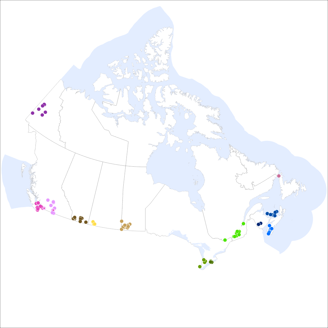
A Priority Place is an area of high biodiversity value that is seen as a distinct place with a common ecological theme by the people who live and work there. As part of the Pan-Canadian approach to transforming species at risk conservation in Canada, a total of 11 Priority Places were affirmed by federal, provincial, and territorial governments in December 2018. One additional priority place was affirmed in 2024. The places selected have significant biodiversity, concentrations of species at risk, and opportunities to advance conservation efforts. In each Priority Place, the federal and provincial or territorial governments are working with Indigenous Peoples, partners, and stakeholders to develop conservation implementation plans.
This dataset captures a small sample of the projects that are underway in these Priority Places. Over time, it will be expanded to include more projects. Some projects span various areas of a Priority Place but are reflected in this dataset as a single center point. This dataset is not to be used for legal purposes.
Basic view
Metadata Record Information
- File Identifier
- 91219d24-e877-4c8a-8bd2-b2b662e573e0 XML
- Date Stamp
- 2025-11-12T19:00:35.667Z
- Metadata language
-
eng; CAN
- Character set
- UTF8
- Hierarchy Level
- Dataset
Data identification
- Title
-
Priority Places For Species at Risk (Terrestrial): Projects
- Date (Creation)
- 2020-08-01
- Date (Publication)
- 2022-03-10
- Date (Revision)
- 2025-11-12
- Status
- Completed
- Metadata language
-
eng; CAN, fr; CAN
- Character set
- utf8
- Topic category
-
- Biota
- Boundaries
- Environment
- Maintenance and Update Frequency
- As needed
- Spatial representation type
- Vector
Keywords
- Theme
-
-
Priority Place
-
Pan-Canadian approach
-
Species at Risk
-
Migratory Birds
-
Biodiversity
-
Canada Nature Fund
-
Conservation Action Plan
-
- Place
-
-
Kespukwitk / Southwest Nova Scotia
-
Wolastok / Saint John River
-
PEI Forested Landscape
-
St Lawrence Lowlands
-
Long Point Walsingham Forest
-
Southwest Manitoba
-
South of the Divide
-
Summit to Sage
-
Dry Interior British Columbia
-
Southwest British Columbia
-
Yukon South Beringia
-
Limestone Landscapes of the Great Northern Peninsula
-
Carolinian Zone
-
-
Government of Canada Core Subject Thesaurus
-
-
Boundaries
-
Endangered species
-
Environment
-
-
Business Functions
-
-
Plans and Reports for Species
-
Protect Species Well-Being
-
- Use Limitation
-
Open Government Licence - Canada ( http://open.canada.ca/en/open-government-licence-canada)
- Access Constraints
- License
- Use Constraints
- License
- Begin Date
- 2020-08-01
- End Date
- 2024-10-23
Extent
))
Ref. system Reference Systems
- Reference system identifier
- http://www.epsg-registry.org / EPSG:3978 /
Distribution
Distribution Formats
- Distribution format
-
- FGDB/GDB ( 1)
Overviews
)))
Provided by
