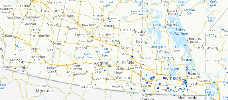
Lake Winnipeg Basin Stewardship Fund - Map of Funded Projects
The Government of Canada is committed to the long-term sustainability of Canada's lakes and waterways to ensure that there is clean water for all Canadians, both for this, and future, generations. To this end, on August 2nd, 2012, Prime Minister Stephen Harper announced the launch of Phase II of the Lake Winnipeg Basin Initiative (LWBI) with a five-year (2012-2017), $18 million investment through the Action Plan for Clean Water that will focus on improving water quality for people living in the region, as well as for fish and wildlife in and surrounding Lake Winnipeg.
The Lake Winnipeg Basin Initiative aims to restore the ecological health of Lake Winnipeg, reduce pollution from sources such as agriculture, industry and wastewater, and improve water quality for fisheries and recreation. The Lake Winnipeg ecosystem supports an annual freshwater fishery of $50 million and a $110 million recreation and tourism industry.
In addition, the Government of Canada is also providing support for community based projects through the Lake Winnipeg Basin Stewardship Fund - part of the Lake Winnipeg Basin Initiative and administered through Environment Canada's Lake Winnipeg Basin Office. The fund is cleaning up Lake Winnipeg by providing support to action-oriented water stewardship projects led by communities, conservation authorities, non-profit organizations and academic institutions.
The following is a map describing the Lake Winnipeg Basin Stewardship Fund's funded projects at their geographical locations in Google earth.
To download Google earth copy this link,
Basic view
Metadata Record Information
- File Identifier
- 7816268a-aafa-43cf-91d2-259fca183d07 XML
- Date Stamp
- 2022-01-26T01:55:51
- Metadata language
-
eng; CAN
- Character set
- UTF8
- Hierarchy Level
- Series
http://ec.gc.ca
Data identification
- Date (Creation)
- 2015-02-24
- Date (Publication)
- 2015-02-24
- Status
- Completed
- Metadata language
-
eng; CAN
- Character set
- UTF8
- Topic category
-
- Imagery base maps earth cover
- Maintenance and Update Frequency
- As needed
- Spatial representation type
- Vector
- Hours of Service
-
8:00-4:00pm
Keywords
-
ECCC Information Category EN
-
-
Water
-
-
Geography
-
-
Water - Major drainage area - Western and Northern Hudson Bay
-
-
Business Functions
-
-
Engagement and Partnership with External Regulators and Governing Bodies
-
Set-up and Administer Grants & Contributions Agreements for External Regulators and Governing Bodies
-
-
Government of Canada Core Subject Thesaurus
-
-
Sustainable development
-
Lakes
-
Funding
-
-
external.theme.EC_Branch
-
-
Regional Directors General Offices
-
-
external.theme.EC_Directorate
-
-
West and North Regions
-
-
external.theme.GC_Security_Level
-
-
Unclassified
-
- Use Limitation
-
Open Government Licence - Canada ( http://open.canada.ca/en/open-government-licence-canada )
- Access Constraints
- License
- Use Constraints
- License
- Begin Date
- 2015-02-24
Extent
))
Ref. system Reference Systems
- Reference system identifier
- EPSG / EPSG:4326 /
Distribution
Distribution Formats
- Distribution format
-
-
SHP
(
1.0
)
-
CSV
(
1.0
)
-
JSON
(
Unknown
)
-
SHP
(
1.0
)
http://ec.gc.ca
Overviews
Provided by