Satellite Imagery - GOES-East
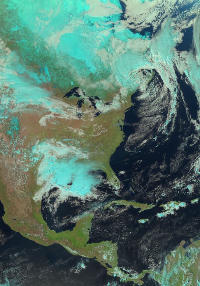
These products are derived from RGB (red/green/blue) images, a satellite processing technique that uses a combination of satellite sensor bands (also called channels) and applies a red/green/blue (RGB) filter to each of them. The result is a false-color image, i.e. an image that does not correspond to what the human eye would see, but offers high contrast between different cloud types and surface features. The on-board sensor of a weather satellite obtains two basic types of information: visible light data (reflected light) reflecting off clouds and different surface types, also known as "reflectance", and infrared data (emitted radiation) which are short-wave and long-wave radiation emitted by clouds and surface features. RGBs are specially designed to combine this type of satellite data, resulting in an information-rich final product.
Other products are based on the enhancement of channel data for a single wavelength, also aimed at highlighting meteorological features of the observed surface or clouds, but in a simpler way since only a single wavelength is involved. This older approach is still useful today, as its simplicity makes image interpretation easier in some cases.
Basic view
Metadata Record Information
- File Identifier
- 4564cbf5-9de5-4521-b007-a20d73ad6f89 XML
- Date Stamp
- 2025-10-07T11:19:03.173Z
- Metadata language
-
eng; CAN
- Character set
- UTF8
- Hierarchy Level
- Dataset
+01-506-451-6010
Data identification
- Title
-
Satellite Imagery - GOES-East
- Date (Publication)
- 2024-10-28
- Date (Creation)
- 2023-11-17
- Status
- On going
- Metadata language
-
eng; CAN
- Character set
- utf8
- Topic category
-
- Climatology, meteorology, atmosphere
- Maintenance and Update Frequency
- Continual
- Spatial representation type
- Grid
+01-506-451-6010
Keywords
- Theme
-
-
Atmospheric conditions
-
Visible
-
Infrared
-
Clouds and weather
-
Aviation weather
-
Convective weather
-
Fire weather
-
Fog and low stratus
-
Snow and ice
-
Earth observation
-
-
Government of Canada Core Subject Thesaurus
-
-
Satellite images
-
Remote sensing
-
Meteorology
-
-
Business Functions
-
-
Provide Weather Information Products and Services
-
Deliver Weather Products and Services to Clients
-
-
Branch
-
-
Meteorological Service of Canada
-
-
Directorate
-
-
Weather and Environmental Operations
-
-
Geography
-
-
International
-
- Use Limitation
-
Open Government Licence - Canada ( http://open.canada.ca/en/open-government-licence-canada)
- Access Constraints
- Other restrictions
- Use Constraints
- Other restrictions
- Begin Date
- 2023-11-17
Extent
))
Ref. system Reference Systems
- Reference system identifier
- http://www.epsg-registry.org / EPSG:4326 /
Distribution
Distribution Formats
- Distribution format
-
- WMS ( 1.3.0)
- GeoTIF ( 1.0)
+01-506-451-6010
Overviews
Provided by
