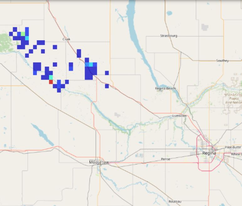
Lightning Density Data
The Canadian Lightning Detection Network (CLDN) provides lightning monitoring across most of Canada. The data distributed here represents a spatio-temporal aggregation of the observations of this network available with an accuracy of a few hundred meters. More precisely, every 10 minutes, the reported observations are processed in the following way: The location of observed lightning (cloud-to-ground and intra-cloud) in the last 10 minutes is extracted. Using a regular horizontal grid of about 2.5km by 2.5km, the number of observed lightning flashes within each grid cell is calculated. These grid data are normalized by the exact area of each cell (in km2) and by the accumulation period (10min) to obtain an observed flash density expressed in km-2 and min-1. A mask is applied to remove data located more than 250km from Canadian land or sea borders.
Basic view
Metadata Record Information
- File Identifier
- 75dfb8cb-9efc-4c15-bcb5-7562f89517ce XML
- Date Stamp
- 2024-04-09T14:17:33
- Metadata language
-
eng; CAN
- Character set
- UTF8
- Hierarchy Level
- Dataset
+01-506-451-6010
Data identification
- Date (Publication)
- 2023-04-06
- Date (Creation)
- 2023-01-30
- Status
- On going
- Metadata language
-
eng; CAN
- Character set
- utf8
- Topic category
-
- Climatology, meteorology, atmosphere
- Maintenance and Update Frequency
- Continual
- Spatial representation type
- Grid
+01-506-451-6010
Keywords
- Theme
-
-
Lightning
-
Real-time
-
Thunderstorm
-
-
Government of Canada Core Subject Thesaurus
-
-
Storms
-
Detection
-
Weather
-
-
Business Functions
-
-
Provide Weather Information Products and Services
-
Deliver Weather Products and Services to Clients
-
-
Branch
-
-
Meteorological Service of Canada
-
-
Directorate
-
-
Weather and Environmental Operations
-
-
GC Security Level
-
-
Unclassified
-
-
Geography
-
-
National (CA)
-
- Use Limitation
-
Open Government Licence - Canada ( http://open.canada.ca/en/open-government-licence-canada )
- Access Constraints
- Other restrictions
- Use Constraints
- Other restrictions
- Begin Date
- 2023-01-30
Extent
))
Ref. system Reference Systems
- Reference system identifier
- http://www.epsg-registry.org / EPSG:4326 /
Distribution
Distribution Formats
- Distribution format
-
-
WMS
(
1.3.0
)
-
GeoTIF
(
1.0
)
-
WMS
(
1.3.0
)
+01-506-451-6010
Overviews
Provided by